The week ahead: Decidedly warmer, but showers hang around
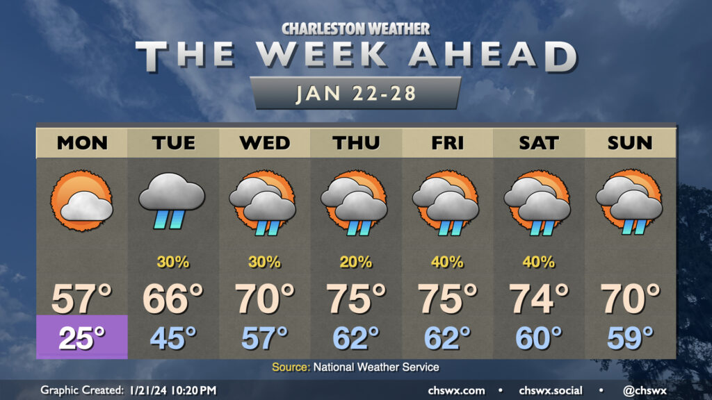
After a quite chilly weekend, we will be thawing out very quickly as we get into the new work week. Monday gets off to one more frigid start with lows in the mid-20s. From there, though, we start to see the arctic airmass begin to modify as a ridge builds aloft and surface high pressure shifts offshore. Monday’s high goes into the mid-50s, much warmer than we were at any point over the weekend. Then it gets downright spring-like: Tuesday warms into the mid-60s after a mid-40s start, and by Wednesday we’re in the 70s. Mid-70s take hold Thursday through Saturday ahead of a cold front, which should help to bring temperatures down a touch by Sunday.
The only fly in the ointment will be scattered shower chances beginning Tuesday and really lasting for the next few days as we sit between an upper trough to the west and ridging to the east. This will transport moisture and occasional upper-level disturbances into the area, and a surface trough along the coast will help act as a focal point for shower development. It won’t rain all the time or all day at any one spot, but all the same you’ll want rain gear handy just in case, especially heading into the weekend as the aforementioned front approaches.