Weekend forecast: Unseasonable warmth comes to an end
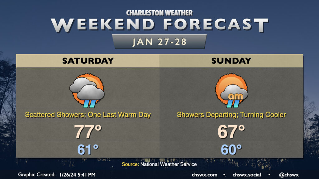
After setting a daily high temperature record and tying the monthly high temperature record for January today, we have one more warm day for Saturday before a front brings temperatures back down to earth on Sunday. We start Saturday in the low 60s once again before warming to the mid-to-upper 70s in the afternoon. Scattered showers should be a factor ahead of the aforementioned front, but coverage won’t really amount to much until we get into the overnight as the front moves by. Showers will taper off early Sunday morning, and as cooler and drier air moves in behind the cold front, cloud cover will break up. Temperatures will be held to the mid-to-upper 60s as gusty west winds — perhaps with gusts approaching 30 MPH in the early afternoon — blow into the area. More normal temperatures return for next week, with a stretch of quiet weather expected to close January and start February.
Today’s records
The high of 83° at the airport today set a new daily record high for January 26. It also tied the record warmest January day, which had been previously set January 16, 1950. Incredibly, you could head just about 15 miles down I-26 to find a much different set of meteorological circumstances: Downtown Charleston topped out at 67° today thanks to the effects of the cooler shelf waters, which included persistent sea fog. Such is the power of cooler water!
Follow my Charleston Weather updates on Mastodon, Bluesky, Instagram, Facebook, or directly in a feed reader. Do you like what you see here? Please consider supporting my independent, hype-averse weather journalism and become a supporter on Patreon for a broader look at all things #chswx!