Weekend forecast: Saturday the pick day to get outside as a storm affects the area Sunday
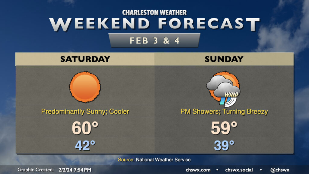
This stretch of quiet weather culminates in a sunny and a bit cooler day on Saturday. A front will come through overnight Friday into early Saturday morning, kicking up the winds a little and swinging them around to the northeast. Temperatures Saturday start in the low 40s, but will only warm to about 60° despite nearly cloudless skies during the day.
Sunday will be a different story. We’ll stay on the cool side with strengthening northeasterly winds throughout the day — expect highs to top out in the upper 50s to around 60° in the afternoon — but cloud cover will be on the increase as a storm system approaches from the west. Showers will advance on the area throughout the day, and we should start to see some showers by early afternoon. Rain will pick up later in the day and especially after sunset. As low pressure to the west and high pressure to the northeast continue to butt up against each other, the pressure gradient will pinch and winds will subsequently increase. We should see gusts to 30 MPH by sunset, and this will continue overnight as rain falls. The rain could be heavy overnight; by the time moisture shunts offshore during the day Monday, some spots could receive an inch and a half of rain with even higher amounts. There will even be a risk for some tidal flooding early Monday morning as well, but it should peak well before commute time. Keep an eye on forecast updates as the details become further refined.