Sunday: Dry most of the day, but showers should arrive late
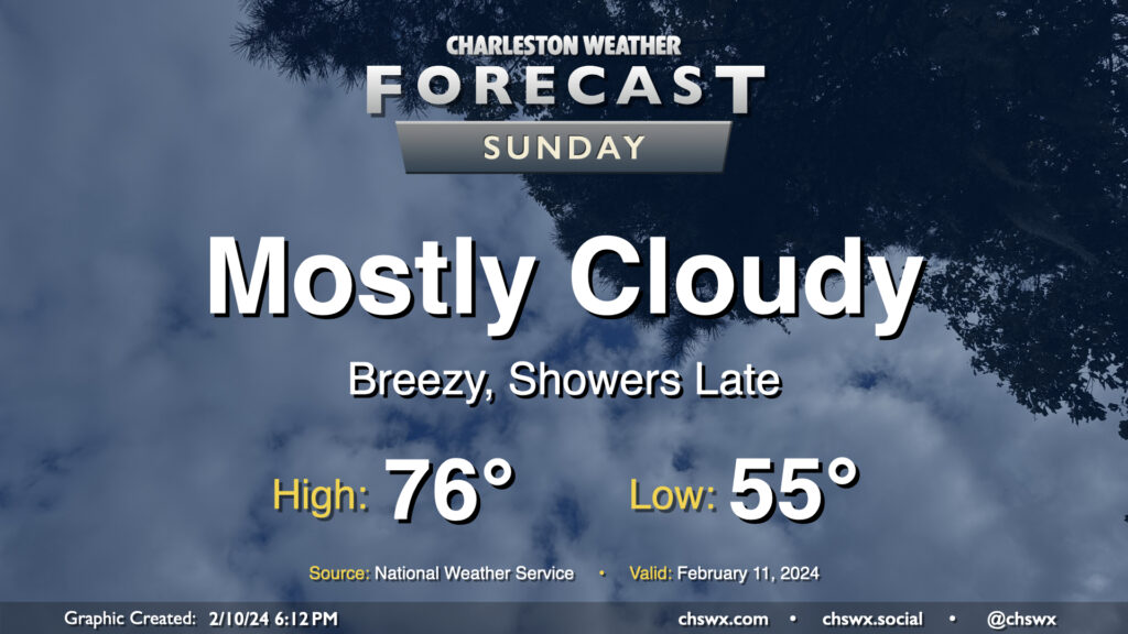
Sunday will be one last warm and largely rain-free day before shower chances arrive in the evening. Temperatures Sunday start in the mid-50s — 10°+ above normal for this point in the year — and head to the mid-70s as warmer and more moist air continues to surge into the area ahead of a storm system approaching from the west. Skies will remain mostly cloudy, though a few breaks in the clouds will still be possible especially in the morning.
By evening, we should start to see some shower activity begin to move in from the west. Guidance increasingly suggests that the best chance for showers Sunday will be found later in the evening and generally inland of 17-A. That being said, it looks like we get much of Sunday in without precipitation; just be ready for some rain as you head to and from any Super Bowl plans you may have.
Bulk of the rain falls Monday; a few strong storms possible
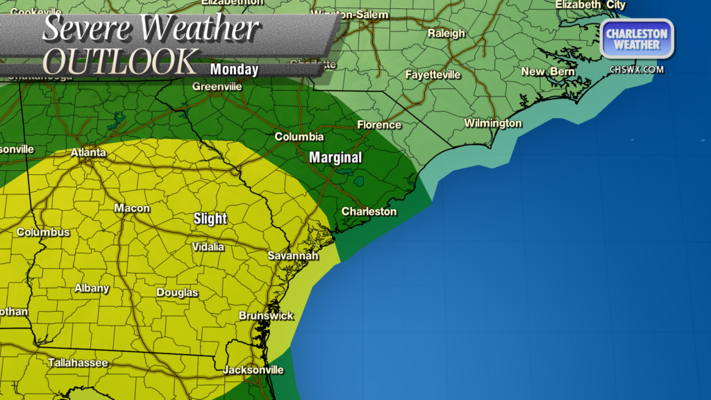
Monday should be a fairly unsettled day across the area as showers and thunderstorms affect us for much of the day. There will be plenty of rain, but it looks like it’ll be spread out fairly well, so the risk for flooding is very low. More interesting could be the risk for a stronger storm or two; depending on if instability can develop — and, as usual, that’s a big if this time of year — we could see some pockets of damaging wind gusts at times. We’ll keep an eye on this, but for now, just expect kind of a lousy weather day Monday; if it looks more likely that it’ll turn into more, I’ll let you know.
Follow my Charleston Weather updates on Mastodon, Bluesky, Instagram, Facebook, or directly in a feed reader. Do you like what you see here? Please consider supporting my independent, hype-averse weather journalism and become a supporter on Patreon for a broader look at all things #chswx!