The week ahead: Starting a bit chilly, but warming up
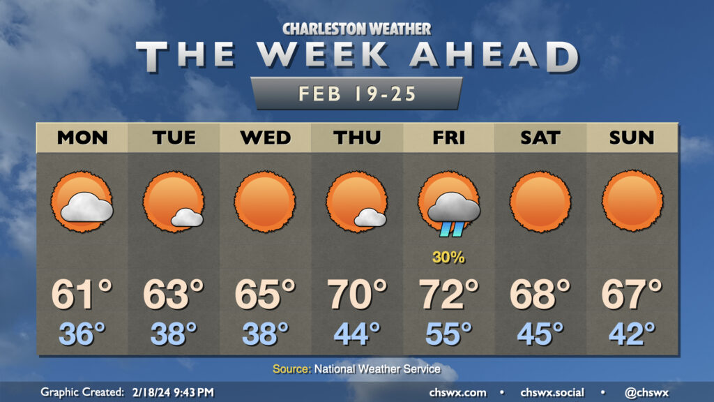
After a fairly dreary weekend (and a particularly chilly Sunday), the sun returns for a majority of the upcoming week (with a good-looking weekend on tap, too, for a change). We will stay on the chilly side for a couple more days, though, with lows in the mid-30s greeting us on Monday. Cloud cover will come and go throughout the day as a disturbance moves across the area, but it’ll be too dry at the surface for any rain. Still, there should be enough sun to get us to the low 60s Monday afternoon.
Mostly clear skies will dominate from Tuesday through Thursday along with a gradual warming trend. Cooler air will continue to blow in Tuesday and to a lesser degree Wednesday, keeping low temperatures in the upper 30s both mornings and highs in the low to mid-60s. This shuts off on Thursday, allowing highs to reach 70° in the afternoon with just a few clouds. Cloud cover will increase overnight Thursday into Friday as a cold front sweeps through; there’s not much moisture but a few showers will be possible ahead of the front. The front’s not incredibly potent, but sweeps in enough cooler and drier air for a very comfortable weekend of weather with plenty of sunshine and highs in the upper 60s.
Follow my Charleston Weather updates on Mastodon, Bluesky, Instagram, Facebook, or directly in a feed reader. Do you like what you see here? Please consider supporting my independent, hype-averse weather journalism and become a supporter on Patreon for a broader look at all things #chswx!