Friday & the weekend: Unsettled start to March
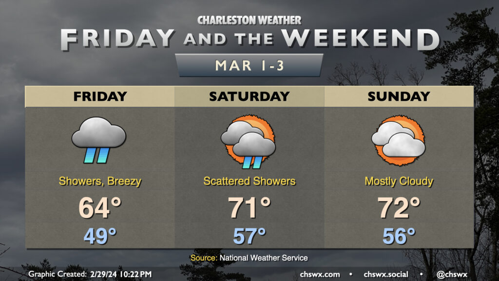
We’ll get March — and climatological spring — off to a fairly wet start on Friday as moisture overruns the area throughout the day. We start the day within range of normal — generally the upper 40s — but only warm to the mid-60s in the afternoon as rain showers increase throughout the day. There could be some pockets of heavy rain at times, particularly depending on the positioning of a developing low pressure system, but right now the risk for the heaviest rain looks to stay offshore. Still, it’ll be a day for the rain gear as rain looks to continue well into Friday night.
Showers will gradually scatter out on Saturday as low pressure departs, though disturbances rippling in the mid-level flow over the area will keep a decent chance at some showers and maybe even a thunderstorm or two in play. We’ll run warmer with some sunshine peeking through at times — expect to start in the mid-50s (well above early March normals) before warming to the low 70s in the afternoon. Shower and storm chances persist into Saturday evening, but will taper off by Sunday morning, which looks to be a rain-free day. A mix of clouds and sun will keep temperatures on the warm side — expect lows in the mid-50s once again to yield to highs in the low 70s in the afternoon.
The new work week will start with quiet weather, though shower chances will kick back up as we head into the meat of the week, with chances peaking Wednesday. Temperatures will run above normal through much of next week.
Follow my Charleston Weather updates on Mastodon, Bluesky, Instagram, Facebook, or directly in a feed reader. Do you like what you see here? Please consider supporting my independent, hype-averse weather journalism and become a supporter on Patreon for a broader look at all things #chswx!