Saturday’s forecast: An unsettled day with the potential for strong thunderstorms and flooding
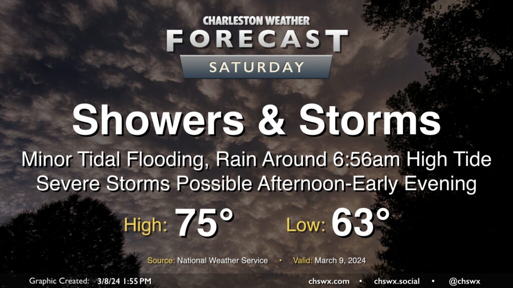
After one round of thunderstorms moved through Wednesday, a second round of unsettled weather, featuring potentially flooding rains in the morning and severe thunderstorms in the afternoon, lies ahead on Saturday.
A warm front moving northward across the area will see temperatures rise throughout the night, and it’s probable we’ll be in the upper 60s as we wake up on Saturday. A batch of heavy rain is expected to accompany the warm front, which could be particularly problematic as the water level in downtown Charleston is expected to reach minor flood stage with the 6:56am high tide. Heavy rain in the area could create a more widespread flooding issue beyond the usual tidal trouble spots, so we will need to watch this during the early morning hours and hope that the timing doesn’t align quite as well as the models currently seem to indicate it will.
From there, we warm into the mid-70s as it looks like there is a midday break in the rain between the warm front lifting north and the cold front sweeping in from the west. This may allow ample time for the atmosphere to destabilize, and this instability combined with favorable wind shear could support a line of strong to severe thunderstorms moving through the area from mid-afternoon through early evening. All modes of severe weather will be possible: damaging straight-line wind gusts, 1” hail, and a tornado or two given the ample turning of wind in the lower half of the atmosphere. As always, if showers persist into much of the day, the severe threat could be lower. Conversely, if we get some peeks of sun, that may increase the risk. Regardless, you’ll want to make sure you have reliable and redundant ways to get weather warnings throughout Saturday to cover the flood threat and the risk for severe weather. Not everyone will see severe weather; in fact, the vast majority of you may not, but you’ll want to be listening for alerts just in case.
The good news is that Sunday looks much nicer, with decreasing cloud cover leading to a mostly sunny day with temperatures topping out in the upper 60s to around 70°.
Follow my Charleston Weather updates on Mastodon, Bluesky, Instagram, Facebook, or directly in a feed reader. Do you like what you see here? Please consider supporting my independent, hype-averse weather journalism and become a supporter on Patreon for a broader look at all things #chswx!