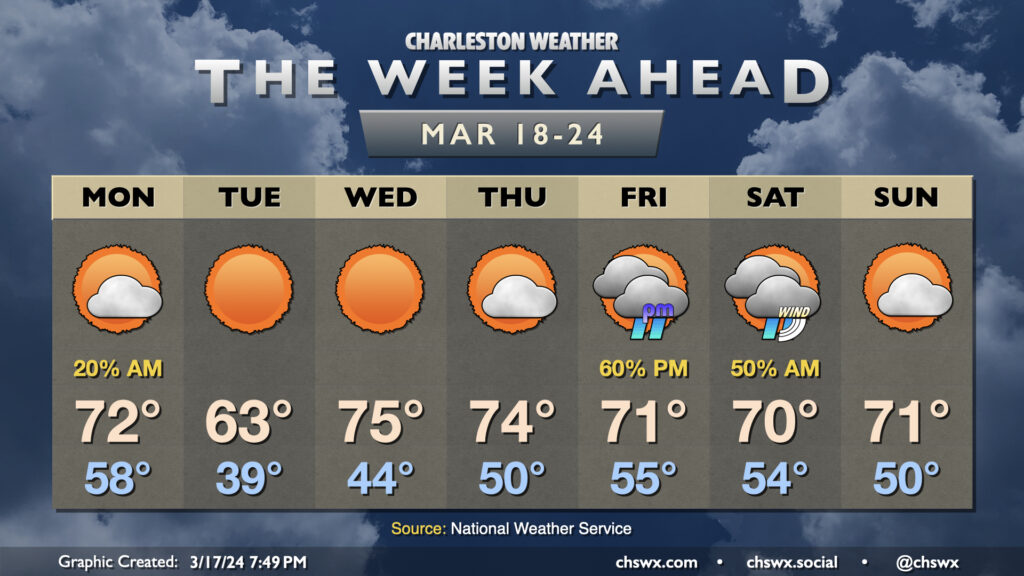
The week ahead: Brief cooldown, then seasonable temperatures return

The week ahead starts off with the aftermath of a cold front, but that won’t be felt long as temperatures head right back toward, if not slightly above, mid-March norms as astronomical spring begins.
First, though, the front: It will swing through overnight into Monday morning, and a few showers could leak over into the morning commute. But otherwise, it’ll be a dry and increasingly sunny day with temperatures peaking in the low 70s before cooler air really punches into the area later in the day.
Tuesday marks the vernal equinox, which puts us into astronomical spring, but it sure as heck won’t feel like it: expect lows in the upper 30s to yield only to highs in the low 60s despite nearly unfettered sunshine. This chill doesn’t last long, though — the core of the cold air moves out overnight Tuesday, and the warm air pump turns back on for Wednesday as winds go southwesterly. We start Wednesday in the mid-40s, warming to the mid-70s under sunny skies. Thursday starts a little warmer but ultimately ends with a similar result as highs top out in the mid-70s under partly cloudy skies.
The next rain chance arrives Friday as low pressure affects the area, potentially skirting up the coast over the weekend. The best rain chance is found late Friday into midday Saturday, but there are some timing discrepancies in the models that’ll need ironing out as we go through the week, so stay tuned for that. Right now, the weekend isn’t a total loss as Sunday appears rain-free. Temperatures will run at or a little below normal over the weekend as we sit in the cool sector of the storm system, but will still be plenty seasonable in the low 70s.
Follow my Charleston Weather updates on Mastodon, Bluesky, Instagram, Facebook, or directly in a feed reader. Do you like what you see here? Please consider supporting my independent, hype-averse weather journalism and become a supporter on Patreon for a broader look at all things #chswx!