Rest of the work week: Turning unsettled late Wednesday night into Thursday, then improving

We have a great weekend of weather ahead, but we’re going to need to get through an unsettled Thursday to get there first.
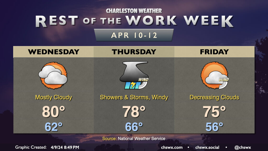
We stay mostly cloudy Wednesday ahead of the storm system that’ll turn Thursday more lousy than not (weather-wise, anyway). Temperatures Wednesday will be on the mild side of normal, with lows in the low 60s yielding to highs around 80° in the afternoon. Southerly winds will be a touch breezy, but nothing too heinous. Minor coastal flooding will be an issue again with the late evening high tide as well, so be ready to reroute around flooded roads.
Rain holds off until early Thursday morning ahead of the front. As a warm front lifts north across the area, we’ll see winds begin to kick up quite a bit, with gusts 30-40 MPH possible outside of thunderstorms. We’ll be in a well-sheared warm sector, but showers should be in the area for much of the day, and this is going to put a governor on how much energy will be available for thunderstorms. Still, if a few thunderstorms do organize, damaging wind gusts will be a distinct possibility, and there’s even the risk for a brief tornado if conditions line up right. The forecast will continue to be fine-tuned during the day Wednesday, so keep an ear out for updates.
Once we get through Thursday, things get a lot better. Friday will run a few degrees cooler and become increasingly sunnier as the day goes on. Expect highs in the mid-70s Friday in the wake of the front, with some gusty winds for one more day as cool air rushes in. Then, the weekend looks excellent, with very few clouds and comfortable mid-April temperatures in the upper 70s to low 80s.
Follow my Charleston Weather updates on Mastodon, Bluesky, Instagram, Facebook, or directly in a feed reader. Do you like what you see here? Please consider supporting my independent, hype-averse weather journalism and become a supporter on Patreon for a broader look at all things #chswx!