Rest of the work week: A couple more unsettled days, then turning drier
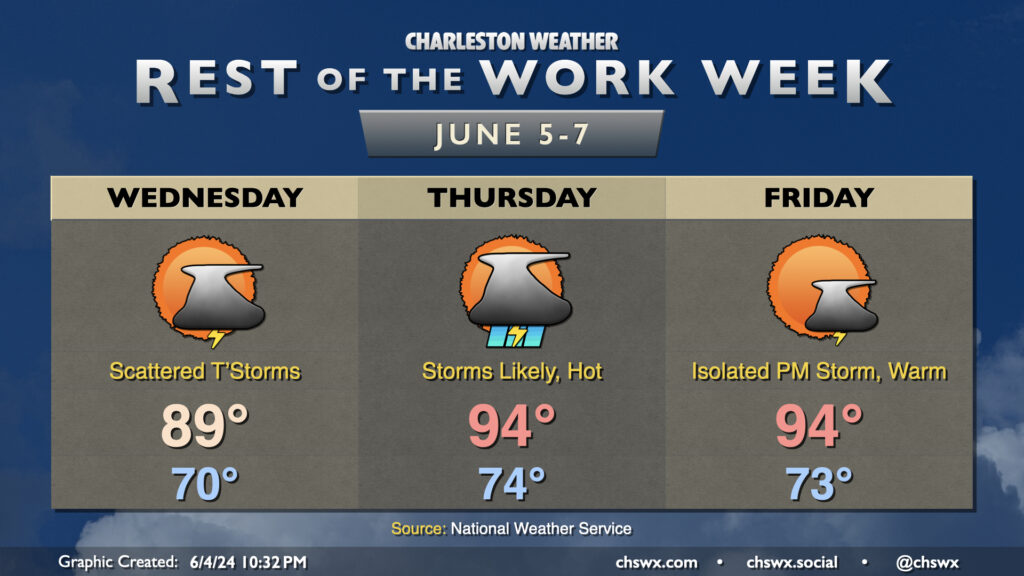
Scattered thunderstorms return to the forecast on Wednesday afternoon, once again focusing inland along and ahead of the seabreeze. It’ll be another mild start around 70°, warming to near 90° in the afternoon. Dewpoints around 70° will help drive heat indices to around the low to mid-90s.
Thunderstorm chances peak Thursday ahead of a cold front. Expect scattered to numerous storms to develop ahead of the seabreeze first as temperatures head to the mid-90s with dewpoints in the low 70s. Heat indices should crack 100° in the afternoon, so if you have outdoor plans, be ready to move those indoors. Thunderstorm chances will approach the coast later Thursday evening into the overnight as the front draws closer, and a stronger storm or two can’t be totally discounted. Be alert to quickly changing conditions if your Thursday night includes some out and about time.
The front clears the area Friday. It won’t get cooler, but the dewpoints will be dropping throughout the day, so while highs top out in the mid-90s once again, we shouldn’t see the heat indices we saw on Thursday. A stray storm might be possible in the afternoon, but all in all we should see plenty of sunshine and a rain-free day for many.