The week ahead: Hot, steamy, but better storm chances
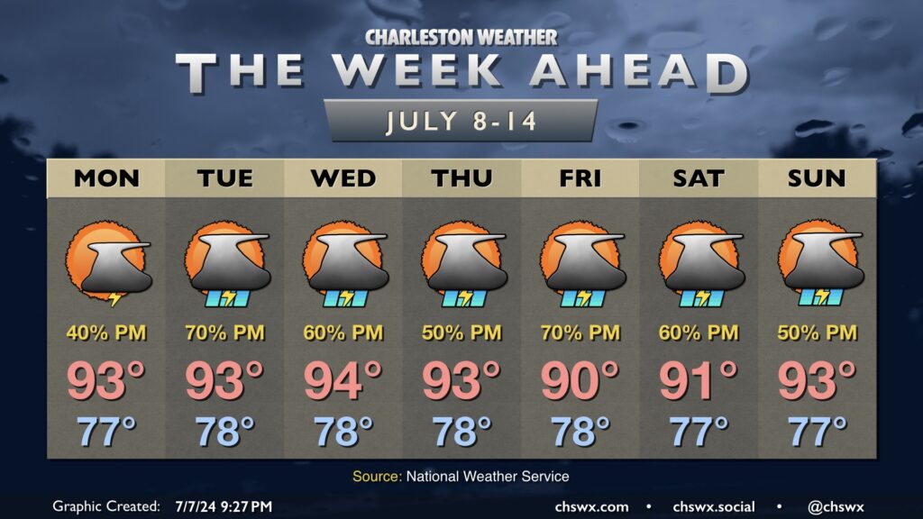
A surface trough and the seabreeze keeps shower and thunderstorm chances in the forecast each afternoon for much of the upcoming week. We’ll stay on the steamy side, though, with temperatures generally in the low to mid-90s each afternoon and lows in the upper 70s inland to low 80s near the coast, where additional record high minimum temperature records could be broken this week.
Monday generally looks like a continuation of the past few days, though with a slightly better chance at an afternoon shower or thunderstorm in the metro area. Still, much of the higher coverage will be found along and west of I-95 for at least one more day. Temperatures will head back to the low-to-mid-90s in the afternoon, though heat indices should cap off below the Heat Advisory threshold of 108°.
Afternoon shower and storm chances improve starting Tuesday afternoon through much of the rest of the week as anomalously high moisture combines with the seabreeze and an inland surface trough to produce scattered to numerous showers and storms each day. Not everyone sees storms every day, but those who do could see some fairly heavy rain at times with storm motions not expecting to amount to very much.
Otherwise, it’ll stay hot: temperatures will continue to run in the low to mid-90s especially though Thursday. Of perhaps greater import are the lows, which won’t dip too far down below 80° away from the coast and may stay in the low 80s closer to the coast as well as in downtown Charleston. This kind of sustained heat gets stressful, especially those with less access to air conditioning. We’ll hope for some well-placed storms to turn the atmosphere over a little and provide some brief relief at times!
Follow my Charleston Weather updates on Mastodon, Bluesky, Instagram, Facebook, or directly in a feed reader. Do you like what you see here? Please consider supporting my independent, hype-averse weather journalism and become a supporter on Patreon for a broader look at all things #chswx!