Rest of the work week: Occasionally stormy pattern continues
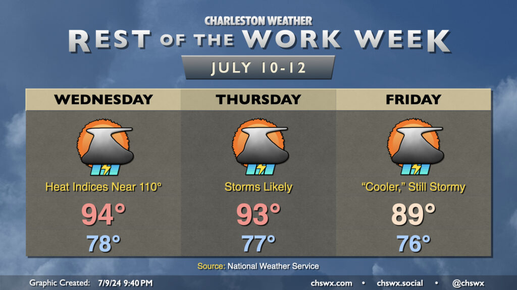
Another hot and potentially stormy day is on tap for Wednesday. We’ll start the day in steamy fashion once more, with upper 70s to start the day away from the even warmer coastline. We’ll warm to the mid-90s in the afternoon, and this combined with mid-to-upper-70s dewpoints will yield heat indices in Heat Advisory territory once again. We should see showers and thunderstorms initiate once again in the afternoon along and ahead of the seabreeze, though it’s worth noting that this evening’s convection-allowing models are showing a bit of a quieter day. We’ll see, though, as it’s often the small-scale influences that can help to drive development this time of year.
Thursday should be a little more active as a front stalls out to our west and a mid-level disturbance approaches from the east. Before storms fire, though, it’s another day in Mother Nature’s sauna with air temperatures in the low to mid-90s feeling like the mid-100s, perhaps flirting with Heat Advisory levels once again. Storms should be generally scattered to widespread in the afternoon and evening with heavy rain once again a possibility.
The aforementioned disturbance interacts with the stalled front to keep showers and storms in the area for a good bit of Friday, with coverage peaking in the climatologically favored afternoon and evening. This will keep temperatures from getting too far out of hand, with highs potentially falling short of 90° for the first time in over a week, though it’ll still be plenty warm. Heavy rain and maybe a strong storm or two remain the main concerns as we sit in a rather moisture-rich environment ahead of the stalled front to the west.