The week ahead: Plenty of opportunities for storms to dent the drought
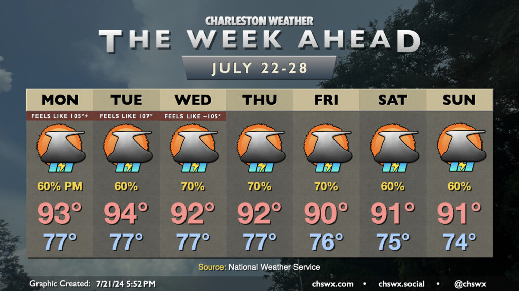
I’m back…just in time for more rain. Showers and thunderstorms figure prominently in the forecast this week, especially in the afternoons and evenings, as the pattern generally keeps a trough in the east and a ridge in the west. This keeps us within southwest flow aloft, which keeps disturbances rippling through the area at times and the flow of moisture open from the Gulf. This, in turn, translates to potentially numerous showers and thunderstorms each afternoon and evening as daytime heating kicks in and the sea breeze makes its inland trek.
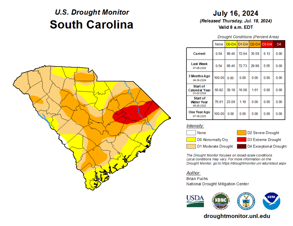
We can certainly use the rain. Last week’s Drought Monitor, released July 18, continues to indicate a moderate drought inland of 17-A, with abnormally dry conditions persisting east of there to the coast. While some downpours on Friday will likely have helped here, some more rain will help, especially further inland. (Provided, of course, it doesn’t all fall at once to cause localized flooding, the potential for which is going to have to be in the back of our minds this week.)
Temperatures will generally run within a couple degrees of normal each afternoon, keeping the standard July heat and humidity in play before storms fire. Muggy starts continue with lows in the upper 70s inland from the coast and lows around or slightly over 80° at the coast each day through the end of the work week, with highs rising into the low-to-mid-90s each afternoon. Slightly greater rain coverage is indicated later this week, and that may in turn drive temperatures a couple degrees below normal in the afternoon, but that means 90° instead of 92° this time of year. Still, aside from maybe Tuesday when heat indices get into the mid-to-upper 100s, we’ll generally avoid that particularly nasty advisory-level heat this week. (Take the wins where you get them, folks.)
Follow my Charleston Weather updates on Mastodon, Bluesky, Instagram, Facebook, or directly in a feed reader. Do you like what you see here? Please consider supporting my independent, hype-averse weather journalism and become a supporter on Patreon for a broader look at all things #chswx!