Rest of the work week: Storm chances increase, temperatures drop a little
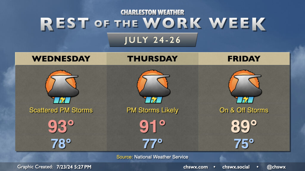
Increasing shower and thunderstorm chances will be in play each starting Wednesday as disturbances within southwest flow aloft add some lift to the generally favorable thermodynamics. Temperatures on Wednesday start in the upper 70s, warming to the low-to-mid-90s by afternoon. As far as storms, some coastal storms, perhaps with waterspouts, will again be possible with the morning land breeze. Then, once the seabreeze becomes established, we should see more in the way of shower and thunderstorm activity inland.
Rain chances tick up even further Thursday and peak Friday as a front sags south nearby. This will help keep highs capped to around if not slightly below normal, especially Friday. Both days, expect decent coverage of showers and thunderstorms especially in the afternoon and evening hours. Heavy rain and a strong storm or two can’t be totally ruled out. Friday looks particularly active with the threat for isolated flooding possible. To this end, The Weather Prediction Center has the area in a slight risk for excessive rainfall. Fingers crossed for no commute problems, but it’s something to watch.