Friday & the weekend: Stormy start, but we salvage Sunday
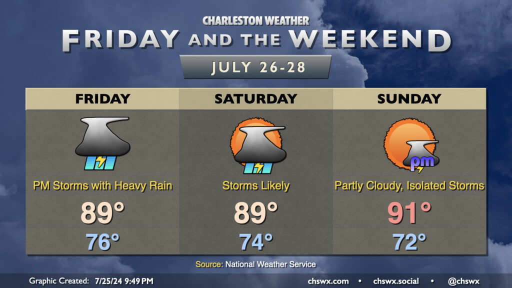
Another round of heavy rain appears to be in the cards for Friday as a front continues to move southward into the very muggy and moist airmass that continues to linger over our neck of the woods. Temperatures start in the mid-70s once again, only warming to the upper 80s thanks to cloud cover and storms which should get going by mid-morning as the seabreeze develops. As of this writing, there is no new Flood Watch, but one could be issued by the time some of you read this in the morning. It won’t rain all day in any one location — this rarely happens in the summer — but where it rains, a lot could fall atop increasingly saturated ground. Stay tuned for possible Flood Advisories during the day Friday.
One more round of storms appears likely on Saturday as the front moves by, with more heavy rain potentially in the cards. Once again, temperatures will be suppressed a bit by the clouds and rain, with highs peaking in the upper 80s. Sunday is emerging as the pick day of the weekend, as the front will be south of here with a little bit of drier air building in featuring mid-to-upper 60s dewpoints, which is quite a contrast from the mid-70s dewpoints that typically characterize summer around here. Cloud cover should be minimal, though a stray afternoon storm can’t be totally ruled out. With the sun back out, expect highs to peak in the low 90s, but the drier air means lows will get to fall a bit, with low 70s expected away from the coast.