Rest of the work week: Fewer storms, more heat
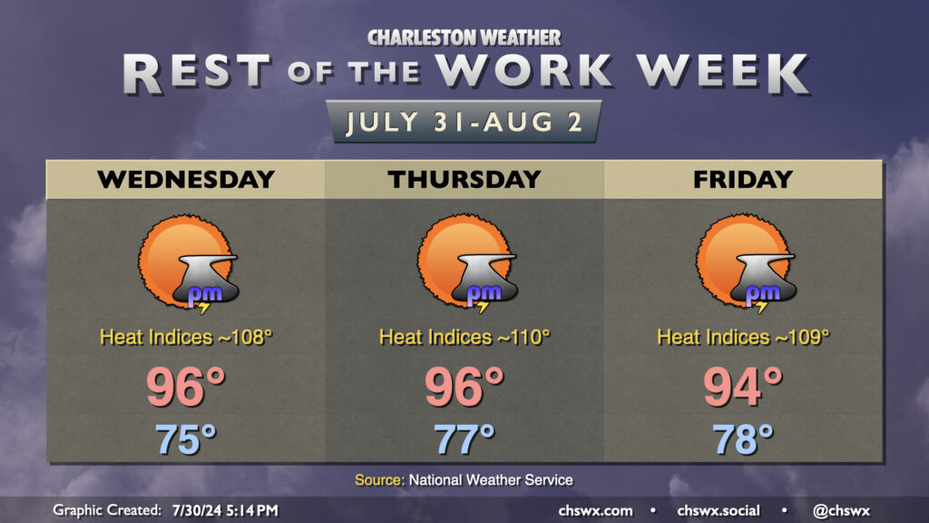
High pressure building in aloft will turn on the heat and keep storms at bay for the rest of the work week. After reaching 93° on Tuesday, we should reach well into the mid-90s for the next few days. Dewpoints surging back into the mid-to-upper 70s will drive heat indices back into Advisory territory possibly as early as Wednesday and more likely on Thursday and Friday. Be ready to take heat precautions once again as you head outside at the height of the afternoons.
Looking for relief from storms? Don’t count on it — the high pressure aloft will generally put a lid on much in the way of thunderstorm activity. If one can get going, then you might get some heavy rain and gusty winds, but otherwise, widespread storm activity doesn’t appear likely until next week.
Tropics: Dry wave up to a 60% chance to develop
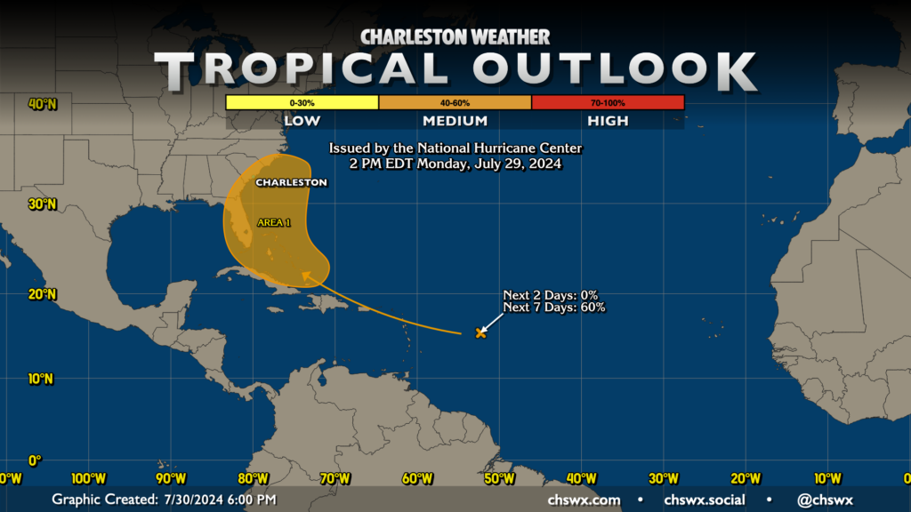
NHC continues to bump up the probability of development for the currently dry wave just west of 50°W, which is now up to a 60% chance to develop in the next seven days. It remains entrenched in dry air, but the expectation continues to be that it’ll start to run into some moisture when it gets near the Bahamas, giving it a shot to develop. The European ensemble members remain the most excited about developing a storm, while the GFS ensemble is a little less enthused — essentially consistent with the past several days of guidance. However, we still have quite a bit of time before we get into the development window for this system, and there’s still a fair bit of room for error as a result. The advice remains the same: keep an eye on this every once in a while, but it’s nothing that we need to get worked up about at this point.
Follow my Charleston Weather updates on Mastodon, Bluesky, Instagram, Facebook, or directly in a feed reader. Do you like what you see here? Please consider supporting my independent, hype-averse weather journalism and become a supporter on Patreon for a broader look at all things #chswx!