Friday and the weekend: Hot again; storms hang around
While Debby shuffles off to the northeast, our weather will remain unsettled as a trough persists aloft across the eastern half of the country. This will drive a surface front just close enough to stall out and keep elevated shower and thunderstorm chances in play each afternoon.
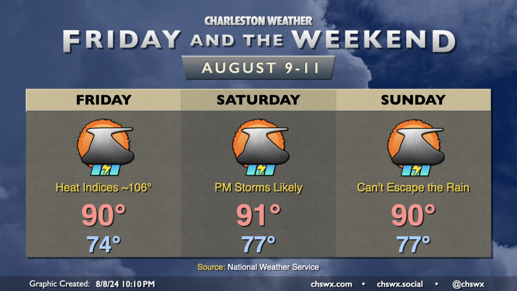
We returned to the 90s on Thursday and will head back there each afternoon for the foreseeable future. Lingering tropical moisture in the wake of Debby will help drive heat indices well into the 100s, perhaps flirting with advisory criteria despite low 90s air temperatures. Then, we should see showers and thunderstorms fire up each afternoon generally along and ahead of the seabreeze. Storm motions will generally be eastward, so some rain could spread to the coast.
River flooding to continue
We will continue to deal with river flooding for several days along the Edisto and Santee rivers. The Edisto is in moderate flood and should crest around 14.6′, just shy of major flood stage, on Tuesday. (Major flood stage at the Edisto at Givhans Ferry starts at 15′.) The Santee will continue generally in minor flood, rising to 15.1′ on Tuesday as well. (Moderate flood at the Santee at Jamestown is 17′, while major flooding starts at 22′.) Major flooding also continues at the French Quarter Creek near Huger, with a slow recession expected over the next few days. Finally, the Ashley River at Cooke Crossroads has perhaps broken its record highest measured crest at 22.77′ (the record is 22.73′, set on February 22, 2021). With an additional inch to inch and a half of rain possible in some spots, we’ll need to monitor areas along rivers and streams closely for exacerbated flooding potential. An Areal Flood Warning remains in effect for the entire Tri-County area through 2:45am August 9, and I expect given heavy rain Thursday night that it will be extended again. Heed all emergency advice from local officials if you are at risk of being impacted by this flooding.
Follow my Charleston Weather updates on Mastodon, Bluesky, Instagram, Facebook, or directly in a feed reader. Do you like what you see here? Please consider supporting my independent, hype-averse weather journalism and become a supporter on Patreon for a broader look at all things #chswx!