Rest of the work week: Cooling trend takes hold, coastal flooding at high tides
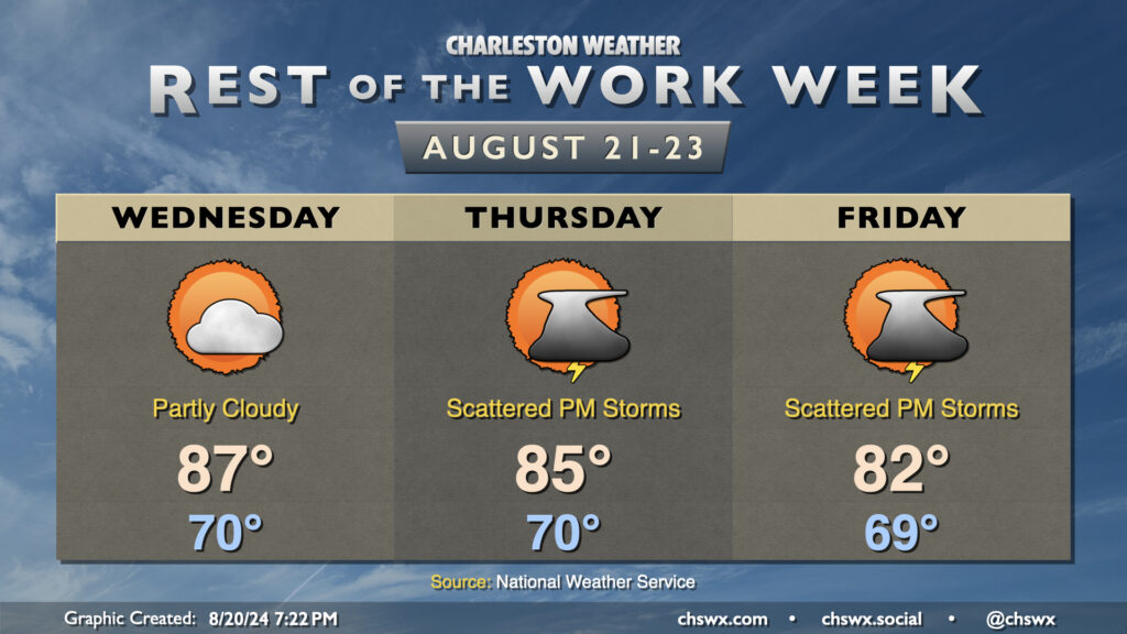
The rest of the work week will feature a cooling trend as high pressure wedges into the area from the northeast and troughing aloft persists. Wednesday should feature a lower storm chance than we’ve seen the past couple days as some drier air takes hold across the area. Temperatures start around 70°, warming to the mid-to-upper 80s in the afternoon with dewpoints in the upper 60s expected.
Thursday into Friday will feature even cooler temperatures as the wedge intensifies over the area; expect mid-80s on Thursday and low 80s on Friday. The intensifying high pressure should lead to a tightening pressure gradient which will drive some gusty winds, particularly around the coast. The onshore winds combined with the recent lunar perigee will also promote coastal flooding around times of high tide (both morning and evening) starting Wednesday evening through at least Friday. Right now generally minor flooding is expected, which is enough to close some of the more vulnerable roads in downtown Charleston.
Shower and thunderstorm chances come back into play for Thursday and Friday as well as more moisture starts to work back into the area, with the best chances of rain closer to the coast. Inland locations may even stay rain-free where drier air is expected to hold firm. No severe weather is expected, though a downpour or two can’t be totally ruled out.