Weekend forecast: Turning warmer with coastal shower chances
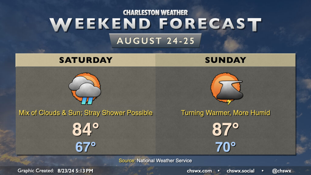
Cool high pressure will hang tough over much of the Carolinas heading into the weekend, though coastal areas could run a little warmer and more humid depending on the position of a stationary front/coastal trough nearby. The trough keeps cloud cover in the forecast for Saturday in particular, and that combined with northeasterly winds will keep temperatures down into the mid-80s in the afternoon after another mid-60s start. A stray shower or thunderstorm will be possible Saturday, particularly closest to the coast, with the nearby trough. A little more humidity creeps into the area for Sunday as winds just off the deck turn more onshore. It remains to be seen just how deep the moisture becomes with some fairly serious differences in model guidance showing up, but ultimately be ready for an isolated storm or two Sunday afternoon. We will see dewpoints return to the low 70s; as high temperatures head to the mid-to-upper 80s, that will yield heat indices in the low 90s. Nothing terribly heinous, though certainly not as comfortable as it has been.
While northeasterly winds continue around the high pressure wedge, the risk for coastal flooding around times of high tide has ended as the tidal departures will stay below flood stage (though they will creep into action stage from time to time). One less thing to worry about, at least. Enjoy the weekend!