Rest of the work week: Cooler, cloudier, occasionally stormy
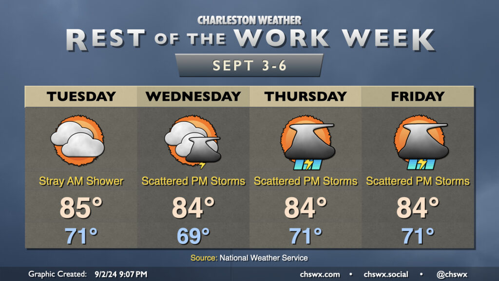
A front will get through the area overnight into Tuesday morning, bringing with it a cooldown that will last for the rest of the week as high pressure wedges southward into the area. Lingering showers should end Tuesday morning, and we should get much of the rest of the day in without any additional measurable rainfall. Clouds will hang around, though, and this will be commonplace for much of the week with the nearby front and ongoing high pressure wedge.
Tuesday’s temperatures will be fairly representative of what we have in store for the rest of the week. Expect lows around 70°, with perhaps some 60s further inland. We’ll warm to the mid-80s in the afternoon, tempered by the northeasterly winds and cloud cover. Dewpoints on Tuesday will run just in the mid-60s, making it the driest-feeling day of the rest of the week as they’ll trend back up to the upper 60s on Wednesday and back to around 70-71° on Thursday and Friday as the stalled front buckles back northward. Shower chances with some rumbles of thunder head up starting Wednesday afternoon and get a little higher Thursday and Friday thanks to the aforementioned front and the return of more quality surface moisture. We’ll keep this going into the weekend, too, before another front sweeps through the area with a reinforcing shot of cooler and drier air to kick off next week.