Friday & the weekend: Tons of sunshine and a quick shot of fall
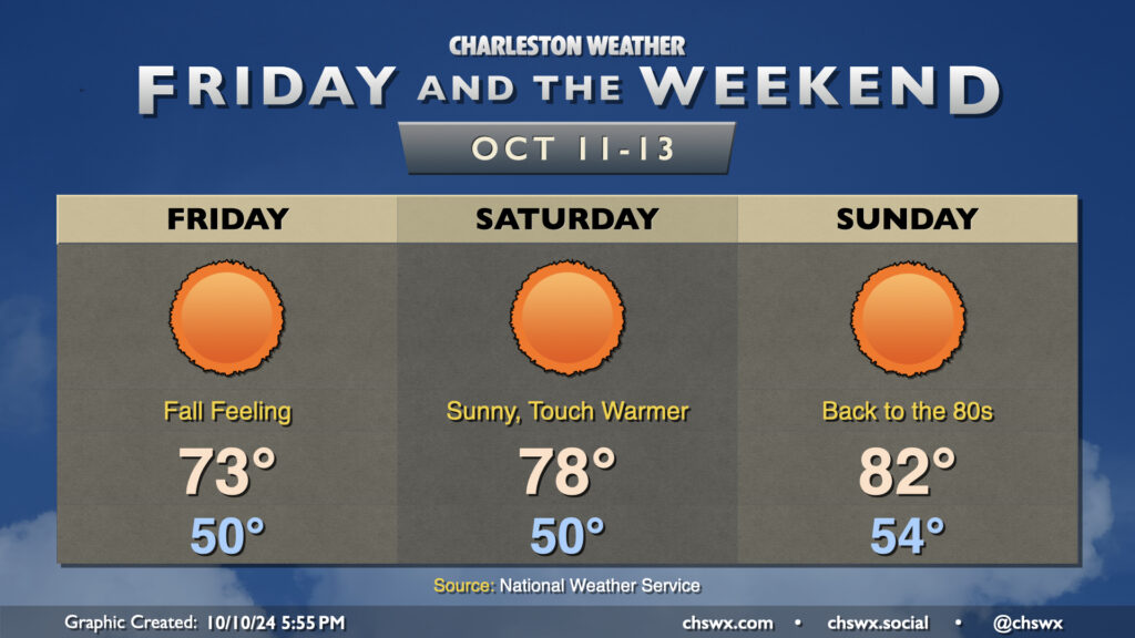
Get ready for the first low 50s of the season starting tomorrow morning! Lows are forecast to bottom out around 50° — and into the upper 40s further inland — for the first time since April 24 on Friday morning. This will yield to highs in the low 70s in the afternoon under predominantly sunny skies. The northeast breeze will still be elevated in the morning, gradually winding down as we get into the evening.
Saturday gets off to a similarly chilly start, though the airmass will begin to moderate as highs climb back into the upper 70s in the afternoon with nearly uninhibited sunshine expected. The warming trend continues Sunday, with a slightly warmer start in the mid-50s warming to highs in the low 80s in the afternoon.
The only weather-related concern of note will be the risk for some minor flooding around the afternoon high tides Friday and again on Saturday as the northeast breeze persists. However, major flooding disruptions do not appear to be in the cards.
Finally, there’s nothing in the tropics we need to be worried about. In fact, it may be a while before we get any more rain. A dry front early next week could usher in even cooler weather, well below normal for mid-October standards. Watching it…