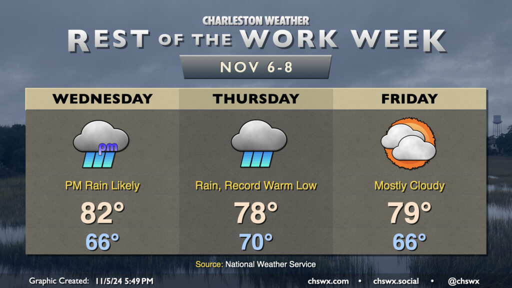
Rest of the work week: Moderate to heavy rain Wednesday into Thursday; drying out for the weekend

Many stations recorded a good bit of measurable rainfall yesterday, and it looks like we have another round of it coming Wednesday evening into Thursday courtesy of the interaction of Tropical Storm Rafael in the Gulf and a cold front. Meanwhile, the airmass remains awfully tropical for early November, and we should set a new record warm low temperature on Thursday as a result.
Wednesday will start out quiet and mild (mid-60s lows expected), but expect showers to increase across the area as we get into the afternoon and evening hours, including around the evening commute. Temperatures top out in the low 80s before rain overtakes the area. We could even hear some rumbles of thunder thanks to the spring-like dewpoints around 70-72°.
Rain continues on Thursday and should be around for much of the day. We start the day around 70° — which would be a record warm low for the date — and warm only to around the upper 70s given the cloud cover and ongoing rainfall. Many spots will end up with 1-2″ of rain before this is over, with even higher amounts possible west of 26. It’s much-needed rain, and given that it’s been so dry, the flooding risk is low (provided pockets of heavier rain don’t train over the same urban areas).
High pressure builds back in for Friday and into the weekend, giving us a chance to dry out. Warmer-than-normal temperatures will persist, with highs in the upper 70s to low 80s continuing each day well into next week.