The week ahead: Seasonable temperatures return

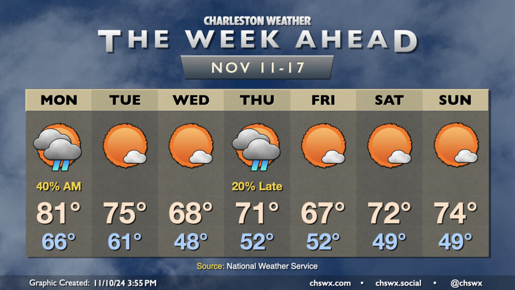
A couple fronts this week will finally restore some order to temperatures that have been well above normal to start November. But first, we’ll get one more day in the 80s on Veterans Day with scattered showers to start the day, which will gradually taper by evening as a cold front moves through the area. This front helps knock temperatures back down to the low 60s Tuesday morning, warming to about the mid-70s in the afternoon under mostly sunny skies.
High pressure to the north will then shift a little eastward, allowing for a wedge pattern with northeasterly winds to start to take shape. This will drive temperatures down to — if not slightly below — normal for Wednesday. We’ll start the day sharply cooler — think upper 40s to around 50° — before warming to the upper 60s, once again under mostly sunny skies.
Another front swings through on Thursday. We’ll turn a little warmer ahead of it, and there may be a few showers associated with it. We start Thursday in the low 50s, warming to the low 70s in the afternoon.
Cooler and drier air behind the front moves in for Friday, and we see highs once again running a touch below normal (upper 60s). The airmass moderates a bit heading into the weekend, which looks quite seasonable and nice with lows in the upper 40s yielding to highs in the low 70s each afternoon under mostly sunny skies.