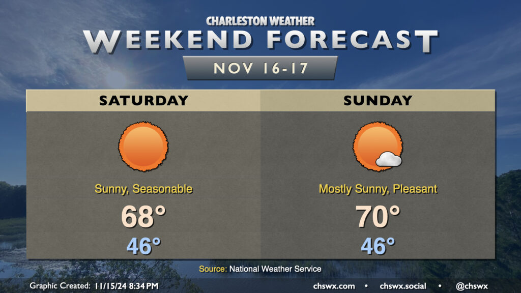
Weekend forecast: Pleasant, seasonable weather; top-25 tide possible Saturday morning

Cool high pressure will be in control this weekend, and we will get a taste of more seasonable conditions for mid-November than we’ve had thus far this month.
First, though, there is the potential for major coastal flooding for the second time in three days with Saturday morning’s high tide, which is predicted around 7:46am. Water levels in Charleston Harbor are projected to peak between 8.1-8.3′ MLLW with this tide, and this will cause numerous road closures throughout downtown Charleston, as well as flooding issues on Isle of Palms, Mt. Pleasant, and perhaps even parts of James Island. Be vigilant and be ready to reroute in case you encounter a flooded road. A Coastal Flood Watch is in effect between 6-10am, and if trends continue, expect this to be upgraded to a Coastal Flood Warning. Also, if the predicted forecast height of 8.2′ comes to pass, it’d be a top-25 tide on record at Charleston Harbor.
Water levels should diminish by mid-morning, and from there, a fairly nice Saturday commences. Expect quite a bit of sunshine, with temperatures warming from the mid-40s in the morning to the upper 60s in the afternoon, just about right on target for normal for this point in the year. Sunday should turn a touch warmer, but a high of 70° is just a teeny bit warmer than normal, so that seasonable feel will continue. Unfortunately, another round of moderate to major coastal flooding is possible with Sunday morning’s high tide, though it should not be as severe as Saturday’s.
From there, a warming trend commences for the first half of the week before a mid-week front. The second half of next week looks much cooler than normal, with highs possibly not making it out of the 50s next Thursday! But let’s enjoy the weekend first.