Rest of the work week: Frontal passage cools us back off

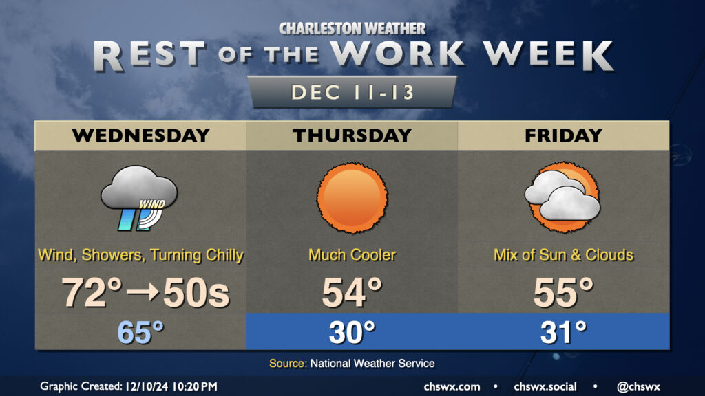
Wednesday will be a fairly unsettled day across the area as a cold front moves by, sending mid-morning temperatures in the 70s down to the 50s before sunset. Showers should be in the area by daybreak, with the greatest risk of showers and maybe even a thunderstorm or two generally mid-morning through early afternoon. A couple of those storms could be on the strong side with strong wind gusts the main concern, though the risk for any severe weather is fairly low. Even outside of thunderstorms, gusts 30-40 MPH will be possible, prompting a Wind Advisory for tidal Berkeley (Daniel Island, Wando, Cainhoy) and Charleston counties from 6am-1pm. Once the front is through, rain chances will end and temperatures will begin to fall like a rock. It won’t feel like it when you leave in the morning, but you’ll probably want a jacket handy as temperatures fall into the 50s by evening.
We’ll wake up to subfreezing temperatures away from the coast on Thursday morning as the much cooler airmass settles into place. Factor in the wind and it’ll feel like the mid-20s to start the day, so be sure to layer appropriately if you’ll be outside. Highs will only head to about the mid-50s despite full sunshine. We’ll dip back into the low 30s for Friday morning with wind chills once again running in the upper 20s. Cloud cover courtesy of a nearby coastal trough will thicken somewhat as the day goes on, though we should see a fair bit of sunshine especially early. Highs once again struggle back to the mid-50s at best.
The weekend turns a bit warmer as high pressure wedging in turns flow a little onshore and cloud cover helps to insulate us at night. Expect lows in the 40s and highs in the mid-60s Saturday. The next shower chances arrive Sunday as a coastal trough moves nearby with temperatures starting around 50°, warming back to the mid-60s once again. Slightly above-normal temperatures continue into the first part of next week, too.
Follow my Charleston Weather updates on Mastodon, Bluesky, Instagram, Facebook, or directly in a feed reader. Do you like what you see here? Please consider supporting my independent, hype-averse weather journalism and become a supporter on Patreon for a broader look at all things #chswx!