Rest of the work week: Dense fog Wednesday morning, then turning a little cooler ahead of a sharper cooldown

A cold front will swing through on Wednesday to put a bit of a governor on the recent unseasonable warmth, but thereafter, expect a much sharper cooldown into the weekend.
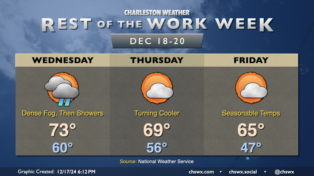
First, though, we start with the risk of dense fog on what will be a rather balmy-for-mid-December Wednesday morning. Lows should only bottom out around 60°. (Keep in mind the normal high for December 18 is 62°.) Fog should be very prevalent beginning late Tuesday night into Wednesday morning. A Dense Fog Advisory goes into effect at 10 PM Tuesday as a result. That advisory will roll until 10 AM Wednesday (or if conditions improve sooner). Use low beams and plenty of patience as you try to get where you are going late tonight into Wednesday morning.
Once the fog dissipates, temperatures will warm to the mid-70s in the afternoon before showers associated with the aforementioned cold front push into the area. A few rumbles of thunder can’t be ruled out, either, but no severe weather is currently expected. We should have some showers in the area for the evening commute, though, so keep this in mind as you head out.
Thursday will run a little on the cooler side, though it’ll still be mild by mid-December standards as temperatures start in the mid-50s, warming to the upper 60s early in the afternoon. Cooler air will be gradually working its way into the area, and we’ll start to really feel that push as we get into the evening.
Friday looks generally quiet with temperatures a few clicks on the warm side of normal. Expect lows in the upper 40s followed by highs in the mid-60s in the afternoon under partly cloudy skies.
A shot of much colder air affects the area for the weekend. Saturday starts in the 30s and only warms to the mid-50s, while Sunday runs even cooler, with lows around freezing warming to around 50° in the afternoon despite mostly sunny skies. This chill lasts through Christmas Eve, though a warming trend should start on Christmas Day.
Follow my Charleston Weather updates on Mastodon, Bluesky, Instagram, Facebook, or directly in a feed reader. Do you like what you see here? Please consider supporting my independent, hype-averse weather journalism and become a supporter on Patreon for a broader look at all things #chswx!