MLK Day: Much colder despite the sunshine as the stage is set for mid-week winter weather

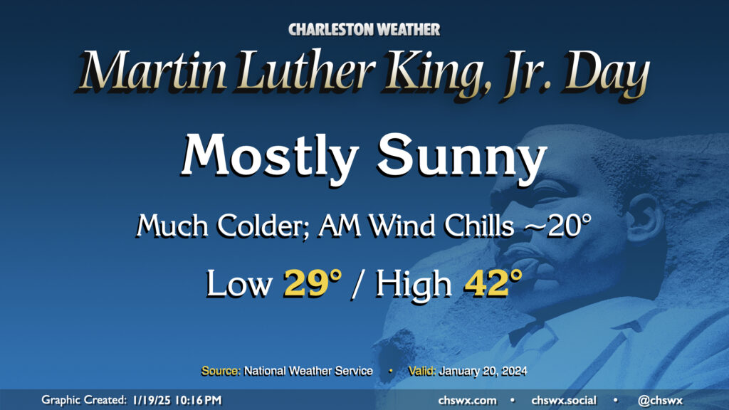
Arctic air will be spilling into the area for Martin Luther King, Jr. Day, bringing the first of several cold days to the Lowcountry. This one will at least come with some sunshine, but even despite that, highs only peak in the low 40s after an upper 20s start. Factor in the wind chill and it’ll feel closer to 20° in the morning, and like the 30s for the balance of the day. Layers will be necessary on Monday and for the next several days as the cold airmass takes residence.
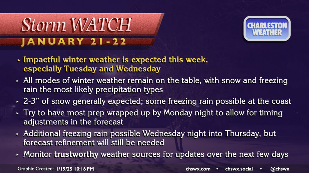
Snow, some ice expected Tuesday afternoon into Wednesday; Winter Storm Watch in effect

The main weather story this week will be the potential for winter weather to affect the area, with perhaps the first accumulating snow since January 2018 in some parts of the Lowcountry. The window for winter weather is generally between Tuesday afternoon into Wednesday morning, with snow the predominant expected precipitation type in the Charleston Metro. Some icing will be possible closer to the coast, but the risk for significant icing looks rather small at this point. Shifts in track to the north and west could allow more moisture into the area, increasing snow totals inland but also increasing the risk of ice at the coast as that would come with a more pronounced warm nose aloft. This is an increasingly unlikely scenario, though.
Regardless of what falls, we have perhaps several days of tricky travel ahead beginning Tuesday night. While precipitation should end around midday Wednesday, anything that can manage to melt will refreeze overnight. We’ll deal with the refreezing threat through Friday, too, especially with a slight chance of freezing rain both Thursday and Friday mornings as a trough develops nearby. We’ll need to take this day by day, but be ready for at least a couple days where venturing too far out probably won’t be the best idea. And remember, traffic lives and dies by bridges and overpasses here in Charleston — and those tend to freeze over first. Crews are treating roads but that might only get us so far.
Finally, the one certainty in all of this is the cold. We’ll run very chilly with perhaps just a few peeks above freezing at times this week. In fact, we could see air temperatures dip into the teens on Thursday morning for the first time since Christmas Eve of 2022, when the low temperature was 18°. Factor in the wind, and we could see wind chills reach 10° or even below that, which would fit the new Extreme Cold Warning criteria for our neck of the woods. You’ll want to make sure your pipes are protected, pets and plants are in a warm place, and the people in your life are in good shape as well.
The forecast will continue to be fine-tuned as we get through Monday and more high-resolution model data comes in, so be sure to listen for updates.
Follow my Charleston Weather updates on Mastodon, Bluesky, Instagram, Facebook, or directly in a feed reader. Do you like what you see here? Please consider supporting my independent, hype-averse weather journalism and become a supporter on Patreon for a broader look at all things #chswx!