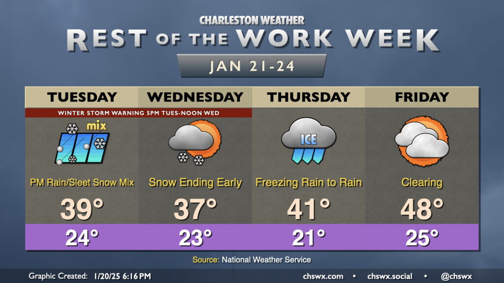
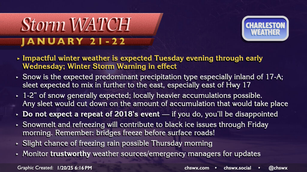
The (abbreviated) work week ahead: Winter storm Tuesday evening into early Wednesday brings road impacts for the rest of the week

The weather story will continue to be the coldest air of the season and an attendant threat of winter weather, especially Tuesday evening through Wednesday morning. Regardless of what ends up falling at your location, it’ll be quite cold, and you’ll need to put your cold weather plans for your home in place each day through the weekend.

We should get through Tuesday morning without much in the way of precipitation. It’ll be a very cold start, though, with lows in the mid-20s combining with breezy northerly winds to drive wind chills into the mid-teens. Temperatures will head a little above freezing going into Tuesday afternoon. Initially, any precipitation that might arrive early should be in the form of rain. We’ll start to see that rain mix in with sleet and snow by Tuesday evening, though, and it’s at that point where you’ll probably want to be where you’re going to be for the storm. The mix should continue through about midnight and change over to all snow through early Wednesday morning. By the time it’s all said and done, most locations should have 1-2″ of accumulation, with locally higher amounts possible. (If sleet is more predominant, that will drive accumulations down.) This is not a 2018 repeat, unfortunately, though you may have enough snow for some dirty snowmen.
Winter weather should depart by noon Wednesday, leaving a chilly day behind. Temperatures should head a little above freezing, though the amount of snow cover could certainly complicate things there depending on how things went the night before. At least the sun will be coming out some before night sets in, but it won’t be enough to melt everything right away, so we can expect refreezing and black ice issues particularly on bridges and overpasses Wednesday night into Thursday morning. Further complicating things could be the potential for some freezing rain Thursday morning as a trough develops offshore; we’ll have to wait and see on this, but it might prolong some issues if it does indeed develop. Thursday morning’s temperatures will be the coldest of the set, with lows dipping into the low 20s in the morning and wind chills possibly scraping the low teens. We should start to see a bit of a “warming” trend develop as highs top out in the low 40s in the afternoon once the rain departs. We’ll still likely be dealing with one more night of refreezing and black ice issues before a precipitation-free Friday that should allow for more melting and evaporation. After another morning in the mid-20s, highs should top out in the upper 40s on Friday, which will feel downright balmy in comparison to the prior few days.
Warming continues as we head into the weekend. Highs on Saturday top out around 50°, while Sunday should approach 60° in most spots after subfreezing starts both days. Monday tops out in the low 60s, albeit with a slight shower chance.
Be safe, be warm, and be dry — it might be a gnarly few days on the roads, but we’ll get through it as we have before.
Follow my Charleston Weather updates on Mastodon, Bluesky, Instagram, Facebook, or directly in a feed reader. Do you like what you see here? Please consider supporting my independent, hype-averse weather journalism and become a supporter on Patreon for a broader look at all things #chswx!