Friday & the weekend: Staying on the warm side to greet February
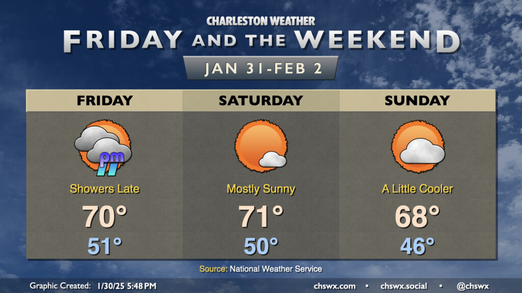
We stay well on the warm side of normal as we finally say goodbye to January and welcome February. Friday will be a mostly cloudy and breezy day ahead of a cold front. Despite the cloud cover, warm air pumping in from the south will drive highs back into the 70s in the afternoon. There will be a risk of showers primarily after sunset through the overnight across the metro area. If you have late Friday plans, be ready to possibly run into some rain. Amounts should generally be light as these showers should be booking it, and they should be gone before sunrise Saturday.
The front clears the area Saturday with some drier air moving in, though we should still see highs top out in the low 70s with much more sunshine. Sunday turns a little cooler as winds turn a little more onshore with high pressure wedging southward into the area. Still, expect highs in the upper 60s under partly cloudy skies — not too shabby, especially if we get caught in a classic Groundhog Day temporal loop. Enjoy!