Rest of the work week: Brief warmth interregnum Wednesday, then back to near record warmth Thursday and beyond
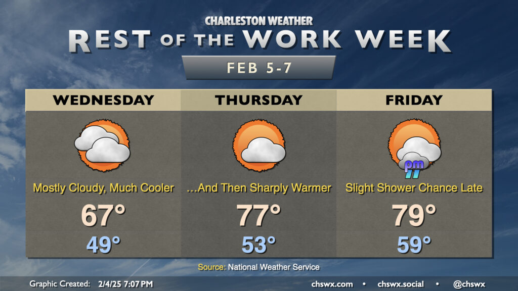
We got very close to tying a record high at the airport on Tuesday as temperatures soared to the low 80s for the first time in 2025. Don’t let your hoodies walk too far, though — high pressure wedging southward will bring much cooler and cloudier conditions for Wednesday. After starting in the upper 40s to around 50°, expect temperatures to only head to the mid-to-upper 60s in the afternoon — a pretty stark contrast to getting into the 80s, that’s for sure.
The cooldown does not last, though. The wedge front moves back north of the area as a warm front on Thursday, and temperatures will once again swing upward in a big way — some 10° warmer than we expect on Wednesday as highs get into the mid-to-upper 70s. Cloud cover will diminish during the day, and it’ll end up being another pretty nice day across the area.
A weak front moves by on Friday, but not before temperatures once again flirt with 80° in the afternoon, potentially approaching the record high set in 2019. In fact, the forecast morning low of 59° is just a few degrees off the normal high of 62°. We’ll see a bit of an uptick in cloud cover associated with the front, and a few showers will be possible later in the day into early Saturday morning. The temperature drop with this front doesn’t amount to much, though, and we stay well above normal for the weekend before another front resets temperatures closer to normal next week.
Follow my Charleston Weather updates on Mastodon, Bluesky, Instagram, Facebook, or directly in a feed reader. Do you like what you see here? Please consider supporting my independent, hype-averse weather journalism and become a supporter on Patreon for a broader look at all things #chswx!