Friday & the weekend: A few showers from time to time, but no washout
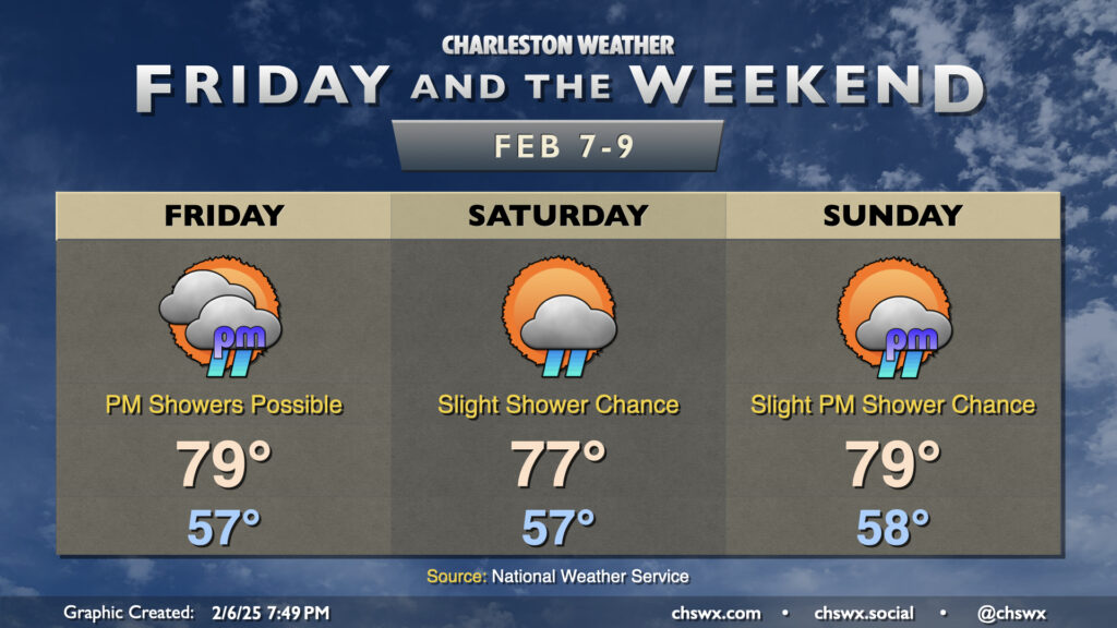
Abnormally warm weather continues for Friday and the weekend as warm high pressure continues to rule the roost for a few more days. We will have a front stall out nearby on Friday; while we’ll be on the warm side of the frontal zone, there’s still a risk for some isolated to scattered showers at time especially getting into the afternoon. A rumble of thunder isn’t totally out of the question, either. Despite the slight risk of showers, temperatures should still head into the upper 70s, threatening February 7’s daily record high of 80° set in 2019.
The front retreats a bit on Saturday, though a shower or two can’t still be totally discounted. It should otherwise be a fine day, with temperatures in the mid-50s warming to the mid-to-upper 70s once again.
Another front approaches the area on Sunday. Ahead of that front, we’ll make another run at a daily high temperature record (80°, set in 1949) as highs soar back into the upper 70s after an upper 50s start. The day should start mostly sunny, but a few more clouds will filter in heading into the afternoon and evening along with a slight chance of a shower as the front approaches.
Next week starts out a bit cooler (but still warmer than normal) as highs in the mid-60s are expected for Monday and Tuesday. However, we’re back in the low 70s Wednesday and the mid-70s on Thursday despite a generally unsettled pattern taking shape.
Follow my Charleston Weather updates on Mastodon, Bluesky, Instagram, Facebook, or directly in a feed reader. Do you like what you see here? Please consider supporting my independent, hype-averse weather journalism and become a supporter on Patreon for a broader look at all things #chswx!