Rest of the work week: Springlike weather continues before a small cooldown Friday
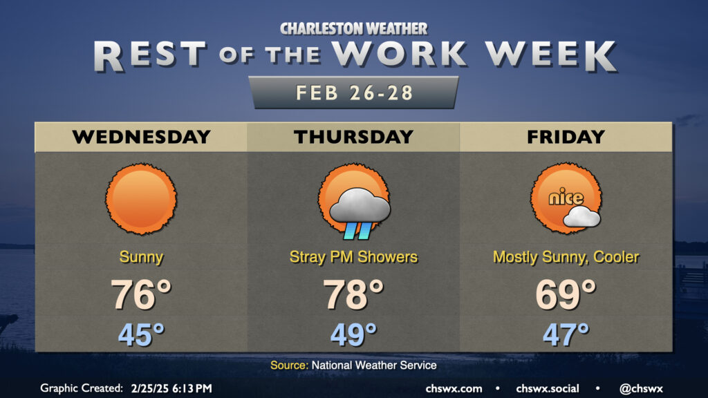
After hitting 76° on Tuesday — 10° above normal, but still 10° below a record — we’re back to the mid-70s on Wednesday with more sunshine expected. Once again, we’ll start the day in the mid-40s, which is close to normal for February 26, but the forecast high of 76° will once again run 10° above normal.
Quiet weather continues for Thursday, though we’ll see an uptick in cloud cover as a cold front approaches the area. Expect temperatures in the upper 40s to start the day, warming to the upper 70s to near 80° in the afternoon despite the uptick in cloud cover as southwest winds ahead of the front pump in warmer air. A shower or two can’t be totally ruled out, but much of us should get the day in rain-free.
The front gets through overnight Thursday into early Friday and will cool us down a fair bit, but temperatures will still run above normal. Expect lows in the mid-to-upper 40s to warm to the upper 60s to near 70° on Friday afternoon with increasingly sunny skies expected. This will lead into a generally nice weekend with plenty of sunshine and comfortable temperatures, especially Saturday before a dry backdoor front cools us off a little on Sunday.
Follow my Charleston Weather updates on Mastodon, Bluesky, Instagram, Facebook, or directly in a feed reader. Do you like what you see here? Please consider supporting my independent, hype-averse weather journalism and become a supporter on Patreon for a broader look at all things #chswx!