Weekend forecast: A springlike Saturday followed by a much cooler Sunday; fire danger persists
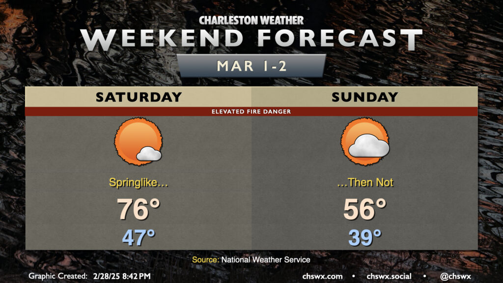
Climatological winter has come to an end, and the first day of climatological spring will certainly feel the part. We’ll start the day in the mid-to-upper 40s, warming solidly into the mid-70s in the afternoon with just a few clouds expected.
A front swings through overnight Saturday, sending temperatures much cooler for Sunday. We’ll start Sunday a bit more on the cloudy side; expect lows to fall into the upper 30s with cooler air blowing in behind the front. Cold high pressure building in will help clear skies out, but it will also drive highs down some 20° cooler than Saturday — think mid-50s vs. mid-70s. Quite a shock!
The main issue we’ll need to watch for is elevated fire danger due to dry fuels and breezy conditions. Gusts over 20 MPH could help a seemingly benign fire spread more than you might think, so please be careful if you must burn.
Finally, the start of climatological spring also signals the beginning of the 2025 growing season, which means that frost and freeze alerts will once again be issued by the National Weather Service in the event temperatures fall to those levels.
Enjoy your weekend!