The week ahead: Unsettled Monday, then a few warm and quiet days
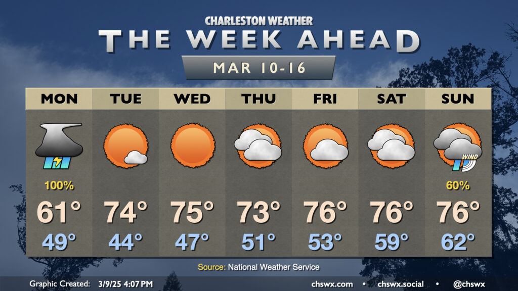
The week ahead starts on an unsettled note, but turns fairly quiet for a few days with a warm stretch of weather featuring temperatures several degrees above normal.
We’ve gotta get through Monday first, though. Showers and a few thunderstorms will remain probable for much of the day, though a brief break could arrive in the afternoon. The rain could be heavy at times — not the worst thing for our drought — but depending on how things set up, it’s not out of the question to see some minor flooding around the 6am high tide downtown as it peaks near the action stage of 6.5′. If downtown is in your morning commute plans, keep that in mind in case you need an alternate route.
Rain will depart as low pressure pulls away overnight Monday into early Tuesday. From there, we’ll start a five-day stretch of quiet and warm weather. Expect mostly sunny skies on Tuesday, with lows in the mid-40s warming to the mid-70s in the afternoon. A gradual warmup of the airmass continues for the rest of the week, with lows steadily creeping up from the mid-40s to the low 50s by Friday. Ahead of a front, the low will barely drop below 60° on Saturday! We’ll see an uptick in cloud cover for the second half of the week as some energy ripples by aloft, but there should be a dearth of moisture to work with for anything precipitating.
The next rain chance arrives Sunday ahead of the next cold front. It remains to be seen if there will be any instability available, but there will be wind shear and overall breezy conditions as we sit within a tight pressure gradient between a 992mb low moving into Canada and a 1028mb high in the Atlantic. If instability can creep in, a few stronger thunderstorms will be possible, but that detail will need refinement as the week goes on. Long story short for this weekend: Saturday is the best day to get your St. Patrick’s Day festivities in with Sunday as a recovery day.
Follow my Charleston Weather updates on Mastodon, Bluesky, Instagram, Facebook, or directly in a feed reader. Do you like what you see here? Please consider supporting my independent, hype-averse weather journalism and become a supporter on Patreon for a broader look at all things #chswx!