Friday & the weekend: Warm week ends with storms on Sunday
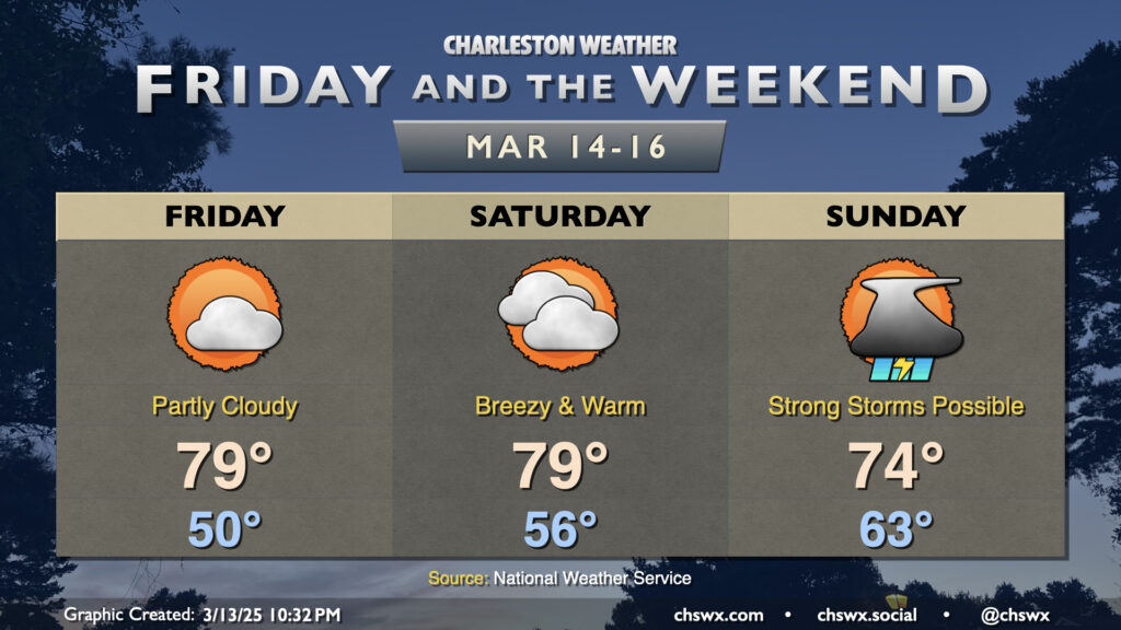
Warm weather continues for Friday and the weekend ahead of our next storm system on Sunday, which could bring us a round of strong to severe thunderstorms.
First, though, clouds scour out and we turn partly cloudy to mostly sunny on Friday as high pressure builds back in briefly across the area. Lows around 50° warm to near 80° in the afternoon; a solid outdoor lunch (or even dinner) day, though mind the pollen — it’s starting to get a little thick out there.
We start to turn breezy Saturday in advance of the storm system that will bring us our Sunday storm chances. We’ll start the day in the mid-50s, warming to the upper 70s to low 80s once again despite increasing cloud cover. Winds will gust 15-20 MPH at times, with a few spots seeing even higher gusts as the pressure gradient between Atlantic high pressure and deepening low pressure across the Midwest gets tighter.
Sunday’s the day to watch for the potential for strong to a few severe thunderstorms depending on how unstable the atmosphere can get. We’ll start the day unseasonably warm, with lows in the low 60s expected. From there, temperatures should warm into the 70s before the squall line arrives. It’s still a bit up in the air when the line ultimately arrives — the ECMWF is the fastest solution bringing the line in by midday, while the GFS and NAM solutions arrive closer to the mid-afternoon/early evening hours. There’s still room to fine-tune this forecast, but for now, the window for any severe weather looks to be between sunrise Sunday and Sunday evening. Damaging wind gusts will be the main concern, but a tornado or two embedded within the line aren’t out of the question, either. A lot will depend on how unstable the atmosphere will be able to get — an earlier passage (or rain developing ahead of the line) would tamp down that greater instability and vice versa. Regardless, the severe threat does not appear to be as significant for us as it looks to be across Mississippi and Alabama on Saturday, where a tornado outbreak is not out of the question. Still, we’ll keep an eye on it through the weekend. Stay tuned!
Follow my Charleston Weather updates on Mastodon, Bluesky, Instagram, Facebook, or directly in a feed reader. Do you like what you see here? Please consider supporting my independent, hype-averse weather journalism and become a supporter on Patreon for a broader look at all things #chswx!