The week ahead: Showers on Monday, but otherwise warm, quiet, and Springy
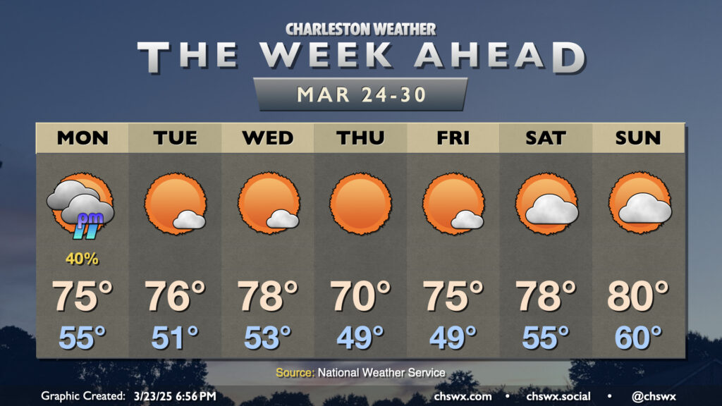
There’s not too terribly much to write home about (weather-wise, anyway) this first full week of astronomical Spring as a series of high pressure systems generally run the show. However, there will be a front approaching with enough moisture return ahead of it for some showers on Monday afternoon. We’ll start Monday in the mid-50s, warming to the mid-70s before showers arrive. Showers shouldn’t be terribly heavy, though a few rumbles of thunder aren’t out of the question with a little elevated instability around. No severe weather is expected, though.
After Monday, we shouldn’t see any rain for the rest of the week. Temperatures Tuesday and Wednesday will run a few degrees above normal, with highs in the mid-70s Tuesday and the upper 70s Wednesday with plenty of sunshine throughout. A dry cold front moves by overnight, and that will take temperatures down a few clicks for Thursday, but lows in the upper 40s and highs around 70° will be hardly uncomfortable, especially with the abundant sunshine. High pressure slips offshore Friday, and temperatures begin to rebound to the mid-70s as a result. Over the weekend, we’ll see a bit more in the way of cloud cover, but rain should hold off as temperatures head into the upper 70s to around 80°.
Follow my Charleston Weather updates on Mastodon, Bluesky, Instagram, Facebook, or directly in a feed reader. Do you like what you see here? Please consider supporting my independent, hype-averse weather journalism and become a supporter on Patreon for a broader look at all things #chswx!