Friday & the weekend: Turning a little warmer (and cloudier); storms possible Sunday
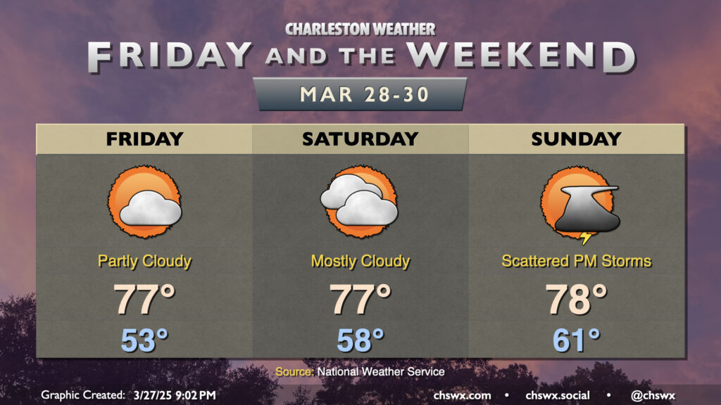
Quiet weather continues for a couple more days, albeit with high pressure slowly losing its grip over the area ahead of the next cold front. We’ll start to warm up as southerly flow develops over the area; expect to start Friday in the low to mid-50s, warming to the mid-to-upper 70s in the afternoon under partly cloudy skies. More clouds filter into the area for Saturday as a bit more in the way of humid air works its way in; expect a warmer start in the upper 50s with highs topping out once again in the mid-to-upper 70s, governed by the increased cloud cover.
The next rain chance arrives on Sunday. (Apparently two rain-free Sundays in a row were just too much to ask.) We’ll start Sunday on the mild side, with lows in the low 60s warming to the upper 70s in the afternoon. As the day goes on, mid-level energy swinging through will gin up some showers and maybe even a few thunderstorms as some weak instability develops. A few folks could see a quarter-inch or more of rain, while others may not measure much of anything. Keep an eye on the weather if you have outdoor activities planned, and have an indoor backup plan just in case.
Looking ahead: A few stronger storms possible Monday
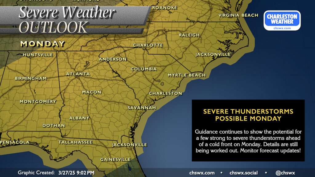
We continue to keep an eye on Monday for the potential for a few strong to severe thunderstorms as a cold front approaches and moves through the area. There’s still decent disagreements within the model suite on things like timing and location of some of the weather features, but generally speaking, it continues to appear that at least some shear and instability will be available for a few stronger storms. (A major outbreak or anything like that doesn’t seem to be in the cards, so it’s nothing to get terribly worked up over.) Details are still tough to nail down at this range, but we should get a clearer picture heading into the weekend as some higher-resolution data begins to come in. For now, just stay tuned as the forecast continues to come into focus.
Follow my Charleston Weather updates on Mastodon, Bluesky, Instagram, Facebook, or directly in a feed reader. Do you like what you see here? Please consider supporting my independent, hype-averse weather journalism and become a supporter on Patreon for a broader look at all things #chswx!