Weekend forecast: Saturday’s quiet, some showers Sunday
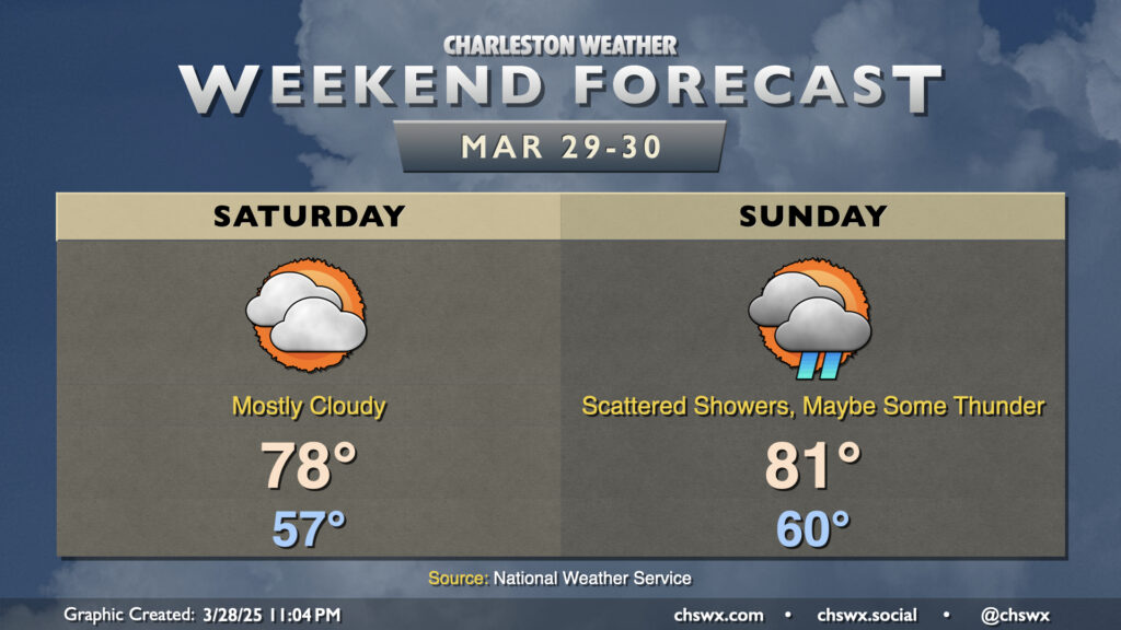
High pressure continues to gradually lose its grip on our weather over the weekend as the next storm system approaches the area. We do get a rain-free day in on Saturday, though, with a mild but mostly cloudy day. We start Saturday in the mid-to-upper 50s, warming to the upper 70s in the afternoon. Southerly winds will generally run around 5-10 MPH.
Shower chances increase for Sunday as some mid-level energy aloft moves its way into the area ahead of the approaching cold front, stirring up some scattered showers and maybe some thunderstorms at times perhaps throughout the day. It won’t be a washout, but you’ll want to keep an eye on the sky as some rain and thunder will be possible from time to time. It’ll be a rather warm day, with lows around 60° warming to the low 80s in the afternoon.
Stronger storms remain possible Monday
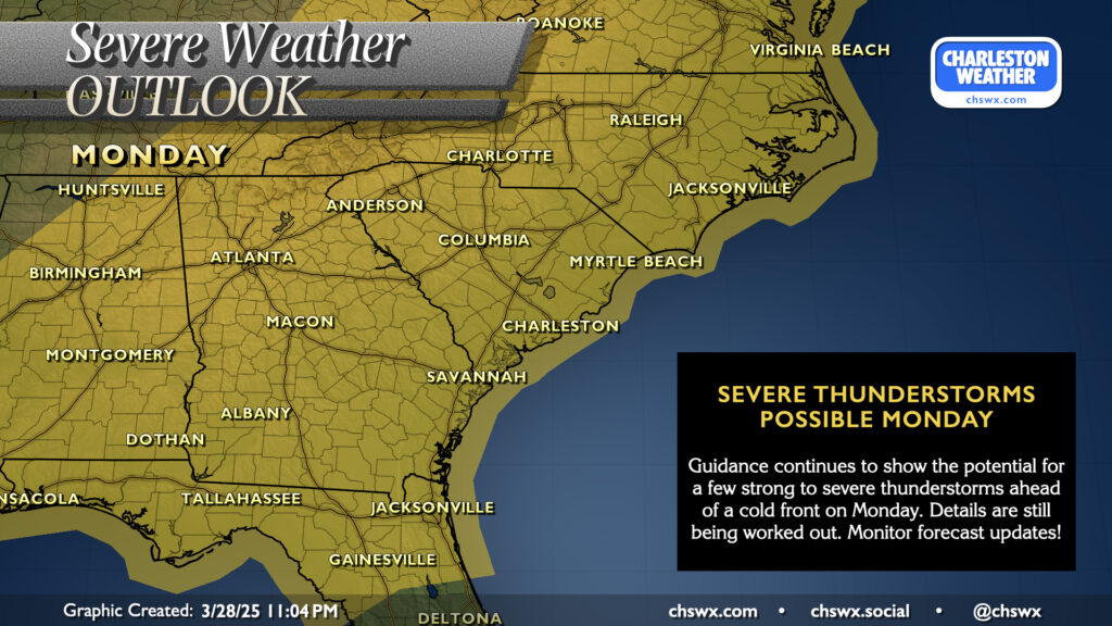
There’s no real change to the outlook for the potential for a few stronger to even severe storms on Monday ahead of a cold front. It’s no slam dunk, though, especially given that storms may arrive later after the heating of the day is lost. Damaging winds are looking like the primary concern from any stronger storm, but again, confidence in any severe weather remains relatively low. More details will come together this weekend, so just keep an eye on forecast updates every once in a while as things get dialed in.
Follow my Charleston Weather updates on Mastodon, Bluesky, Instagram, Facebook, or directly in a feed reader. Do you like what you see here? Please consider supporting my independent, hype-averse weather journalism and become a supporter on Patreon for a broader look at all things #chswx!