The week ahead: Strong storms possible Monday afternoon, then a very warm stretch to start April
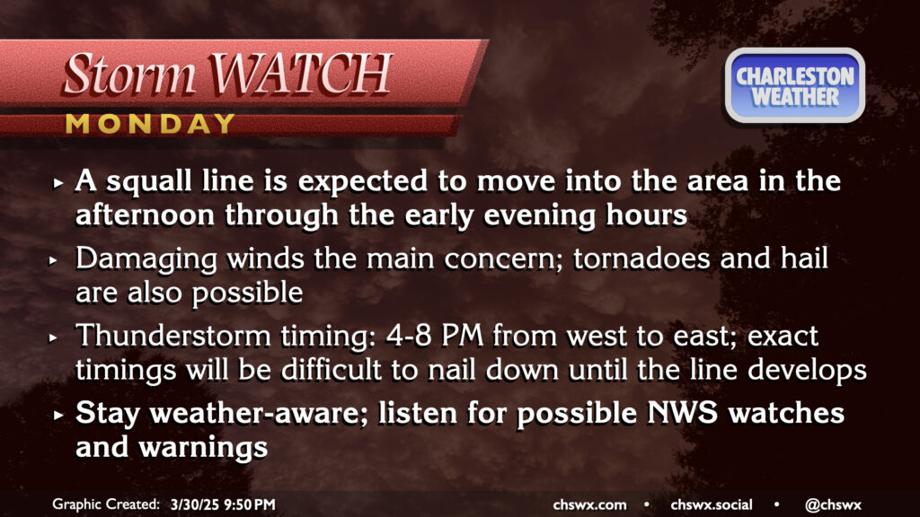
March will conclude on an unsettled and stormy note as a front moves through the area late Monday, bringing with it the risk for strong to severe thunderstorms as a squall line moves by in the late afternoon/early evening hours. It’ll be a very warm end to March, with highs peaking in the low 80s after a start in the low to mid-60s. There should be some breaks in the clouds, and with that, decent instability should develop. The shear is not off the charts, but with the instability and some pockets of drier air aloft, enough is there to support a scattered severe threat with damaging winds the primary concern. A tornado or two on the leading edge of the line can’t be totally ruled out, nor can some hail as well. Timing for thunderstorms is generally in the 4-8PM range from west to east across the metro, so be alert for potential issues during the commute. (The school day should be fine, though after-school stuff might get iffy if storms move a little faster than forecast.)
Warmest stretch of weather this year expected as high pressure dominates
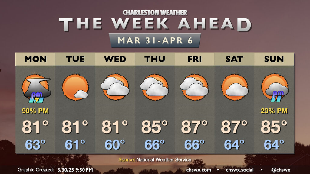
The rest of the week ahead features generally quiet weather as high pressure establishes itself both at the surface and aloft. This will lead to some of the warmest weather so far this year, despite the frontal passage Monday night/early Tuesday morning. Tuesday and Wednesday will be the “coolest” of the set, with lows in the low 60s warming to the low 80s each afternoon. Tuesday will be mostly sunny, while a few more clouds set in for Wednesday.
Thursday through the weekend looks more like a few days in early June than early April. Temperatures will soar into the mid-to-upper 80s each afternoon after starting in the mid-60s. Friday and Saturday will run the warmest, with highs peaking around 87° through a mix of sun and clouds.
Sunday will be another warm day, but changes will be afoot as the next cold front approaches the area. There’s a chance that showers associated with the front could kick off later Sunday, but there’s a long way to go to get exact timings.
Looking ahead: Turning much cooler next week
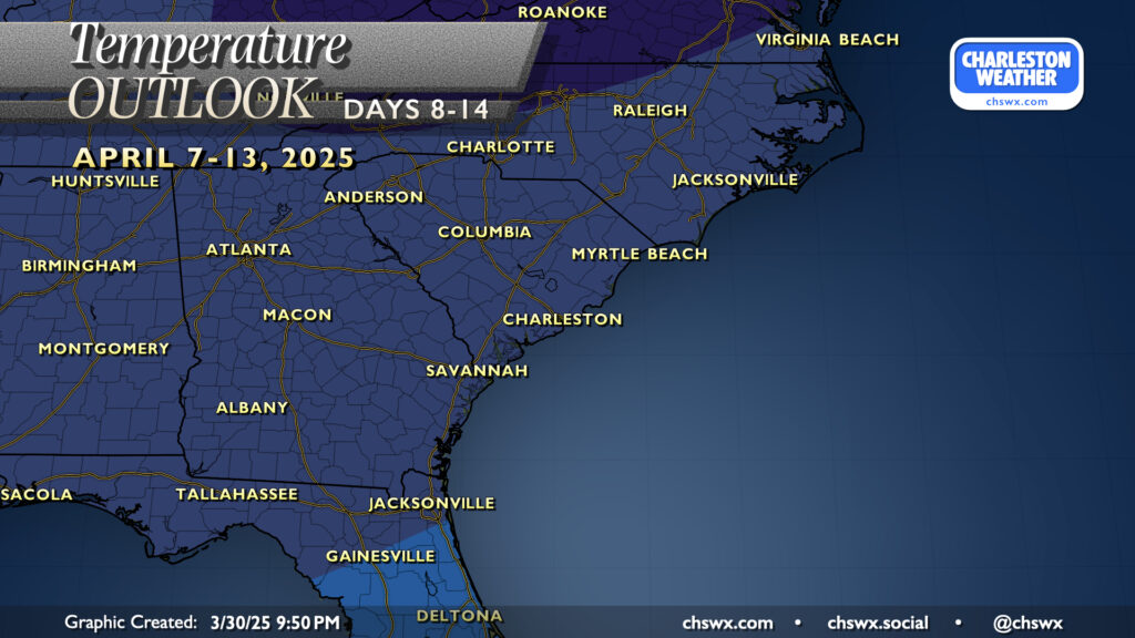
Next Sunday-Monday’s aforementioned cold front will be much stronger, airmass change-wise, than the one affecting our area tomorrow. Much cooler temperatures are expected in its wake, with well below-normal temperatures favored by the Climate Prediction Center. Operational models certainly show plenty of range in just how far below normal temperatures will get, but the bottom line is that Spring’s a transitional season, and cool snaps happen. (Whether frost and freeze issues develop is as yet unknown.)
Follow my Charleston Weather updates on Mastodon, Bluesky, Instagram, Facebook, or directly in a feed reader. Do you like what you see here? Please consider supporting my independent, hype-averse weather journalism and become a supporter on Patreon for a broader look at all things #chswx!