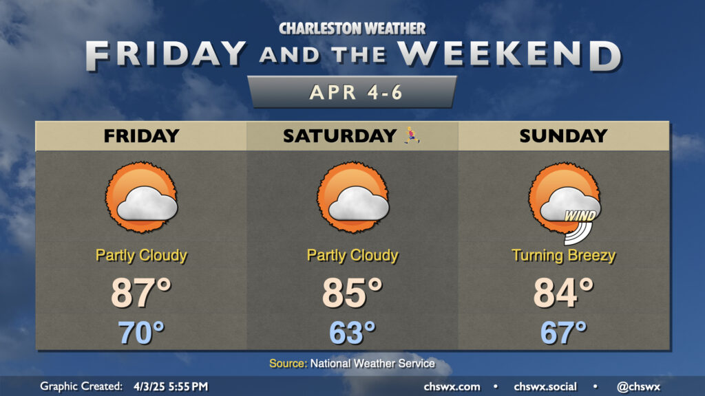
Friday & the weekend: Staying quite warm through Sunday

It will be a very warm Bridge Run weekend as deep-layered high pressure atop the Southeast, in a configuration more reminiscent of summer, hangs around for a few more days. We’re working on a record warm low temperature for Thursday — the low so far of 70° would blow past the previous record of 67° set in 2012 — with maybe a couple more to fall before the weekend is out.
Lows on Friday should only bottom out around 70°, which would tie the record warm low temperature last set in 1970. Highs would then soar to the upper 80s in the afternoon before the seabreeze moves through and cuts temperatures down a bit. Partly cloudy skies will be the general rule, while we stay breezy during the day owing to the pressure gradient between high pressure to the east and the stalled storm system to the west.
The Bridge Run will be on the warm side this go-around on Saturday, with lows in the mid-60s generally expected to warm to the mid-80s in the afternoon. Once again, partly cloudy to mostly sunny skies will dominate, and southerly winds could add a bit of a headwind to runners in the morning.
Sunday runs a touch cooler as we start to see a touch more in the way of cloud cover ahead of the aforementioned storm system to the west, which will be moving into the area late Sunday into Monday. Expect highs to peak in the mid-80s once again on Sunday, with rain holding off until very late. It’ll be turning a bit breezier as the pressure gradient intensifies, so keep that in mind as you head out and about.
Looking ahead: A few storms possible Monday, then turning much cooler
The next rain chance arrives with the storm system on Monday. It’ll be moving somewhat progressively through the area, but we can expect showers and a few thunderstorms during the day as a result. A couple storms could be on the strong to even severe side, but it looks like there will be less instability to work with than we had last Monday. Once the storm system moves by, its cold front will usher in a much cooler airmass, with highs struggling to 70 on Tuesday and not even getting out of the 60s on Wednesday — quite the change from this week’s summer preview!
Follow my Charleston Weather updates on Mastodon, Bluesky, Instagram, Facebook, or directly in a feed reader. Do you like what you see here? Please consider supporting my independent, hype-averse weather journalism and become a supporter on Patreon for a broader look at all things #chswx!