Rest of the work week: Plenty of sunshine ahead
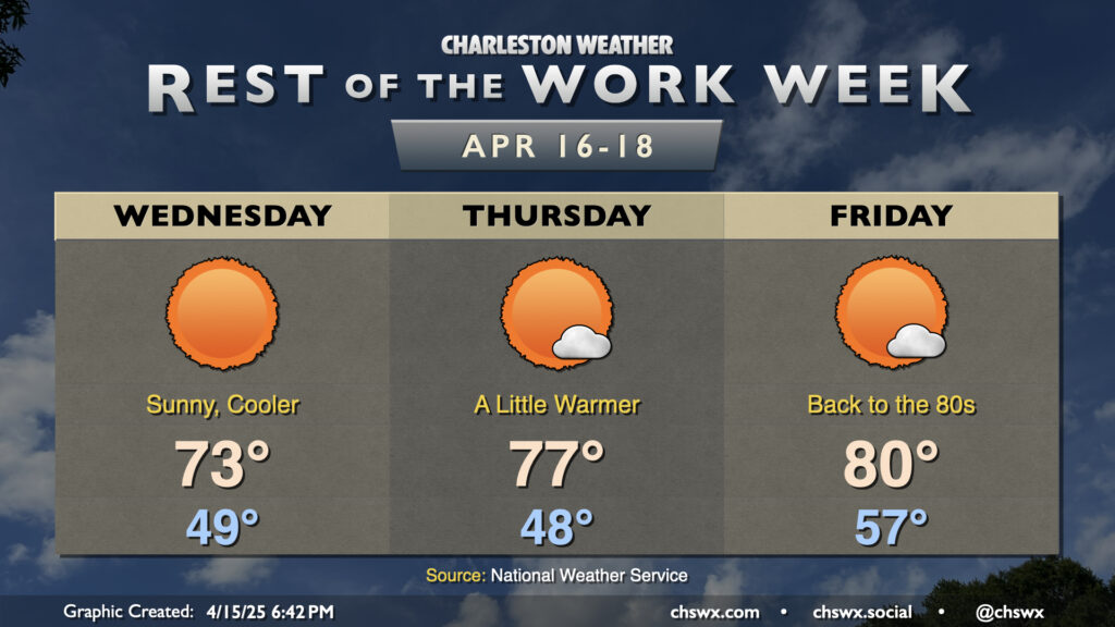
After a cold front clears the area this evening, quiet weather will be the main story through Easter weekend. In the wake of the front, Wednesday will run about 10° cooler than Tuesday did as cooler and drier air moves in. Lows bottom out in the upper 40s, while highs peak right in the low to mid-70s, generally a few degrees below April 16 norms. It’ll be much less windy, thankfully, with winds generally 5-10 MPH.
A warming trend commences Thursday as the airmass quickly modifies. We’ll start in the upper 40s, but warm back to right around normal for this point in the year as highs peak in the mid-to-upper 70s. As high pressure slips offshore, temperatures then head above normal, with 80° readings expected to return Friday afternoon with plenty of sunshine throughout.
We’ll warm into the mid-80s each afternoon this weekend, leading to a toasty Easter Sunday with temperatures peaking right around 85° — thankfully, though, with comfortable humidity. The next rain chance arrives with a front on Tuesday. We could still use the rain as moderate drought remains well-entrenched in the Lowcountry, so it won’t be a bad thing at all (provided no severe weather comes along, but that doesn’t look too likely at this range).
Follow my Charleston Weather updates on Mastodon, Bluesky, Instagram, Facebook, or directly in a feed reader. Do you like what you see here? Please consider supporting my independent, hype-averse weather journalism and become a supporter on Patreon for a broader look at all things #chswx!