The week ahead: Much warmer than normal at times with a few slight storm chances
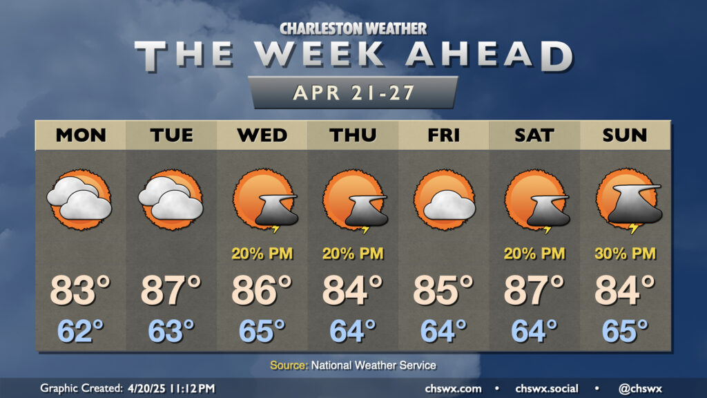
The last full week of April will run rather warm, with 80s throughout. A few storms will be possible midweek and again over the weekend, but no widespread drought relief is expected.
Monday starts in the low 60s, with temperatures warming to the low-to-mid-80s in the afternoon with a mix of sun and clouds expected. We’ll turn even warmer Tuesday as a cold front gets close to the area with a bit more in the way of warm air moving in — expect highs in the mid-to-upper 80s in the afternoon. Moisture will increase ahead of the front as it stalls out to the west, and that will allow the seabreeze to kick off a few storms on Wednesday and Thursday afternoons, though not everyone will see a storm.
The aforementioned front will retreat Friday, bringing about a more rain-free day before shower and storm chances return each afternoon over the upcoming weekend as high pressure aloft breaks down and mid-level energy ripples on by. Highs remain well above normal heading into the weekend, with mid-to-upper 80s possible especially Saturday.
Follow my Charleston Weather updates on Mastodon, Bluesky, Instagram, Facebook, or directly in a feed reader. Do you like what you see here? Please consider supporting my independent, hype-averse weather journalism and become a supporter on Patreon for a broader look at all things #chswx!