Friday & the weekend: A couple more shots at rain, then a quieter Sunday
Warmer-than-normal temperatures will persist for a couple more days before a front cools us off back to late April normals on Sunday.
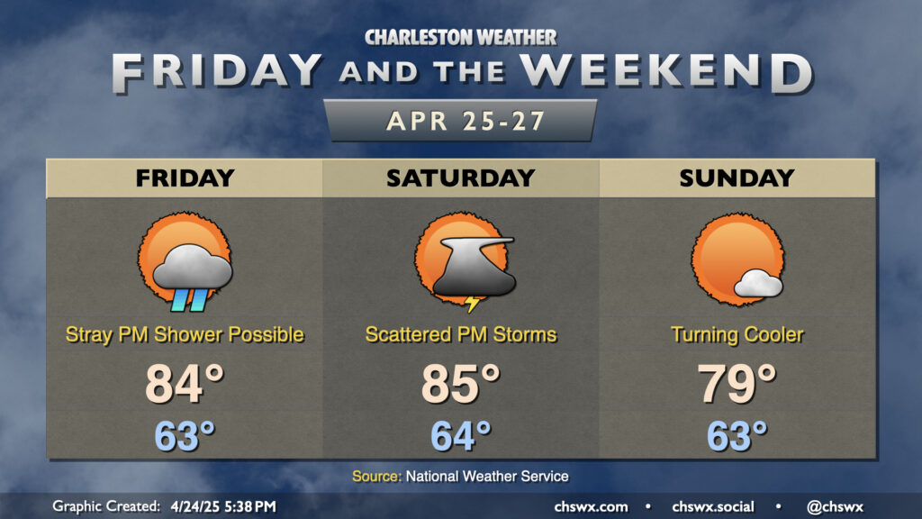
Friday will be a little quieter on radar than Thursday was, when a scattering of showers and thunderstorms developed relatively early in the day and pushed inland with the seabreeze. We start Friday in the low to mid-60s, warming to the mid-80s in the afternoon. A stray shower will be possible on the seabreeze early in the afternoon, but overall the atmosphere will be a bit more capped and less conducive to shower and thunderstorm development.
A cold front approaches the area on Saturday, and rain chances head back up in the afternoon through the evening out ahead of it as a little mid-level energy moves by. A few storms will be possible as well, though severe weather doesn’t look to be a big concern at this point. Temperatures Saturday start in the mid-60s, warming to the mid-80s in the afternoon before showers and storms kick in. A total washout doesn’t appear to be in the cards, but you’ll want to have a Plan B for any outdoor plans just in case.
Sunday will be much quieter as high pressure builds into the area from the north. We’ll start again in the low 60s, but highs should peak in the upper 70s, much closer to late-April normals. Expect plenty of sunshine and a bit of an onshore breeze to keep things comfortable outdoors.
The cooler weather doesn’t last — we’ll close April with temperatures warming back above normal, with mid-to-upper 80s likely returning by mid-week. Dry weather looks to continue for a few more days beyond Sunday, with the next rain chance (albeit a slight one) on Thursday.
Follow my Charleston Weather updates on Mastodon, Bluesky, Instagram, Facebook, or directly in a feed reader. Do you like what you see here? Please consider supporting my independent, hype-averse weather journalism and become a supporter on Patreon for a broader look at all things #chswx!