Friday & the weekend: Abnormally warm temperatures expected
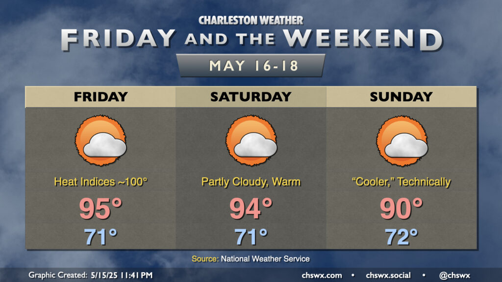
The main weather story for Friday and the weekend will be the unusual midsummer-like heat, especially Friday and Saturday. We may break a record high on Friday — the record high is 94° set in 1941 — as temperatures head into the mid-90s under partly cloudy to mostly sunny skies. Heat indices will peak around 100° or so — not into heat advisory territory but still on the high side for mid-May.
Partly cloudy skies continue into Saturday, though a stalling front could pop a stray storm or two especially further north. Otherwise, expect another quiet and very warm day, with highs in the mid-90s once again expected after a low-70s start. The front meanders around the area on Sunday, keeping partly cloudy skies in the forecast with a stray storm not out of the question. Temperatures should run a touch “cooler” — and by “cooler” I mean around 90° as opposed to 95°.
The 90s stick around well into next week before the next front approaches by mid-week with the next mentionable shower and thunderstorm chances.