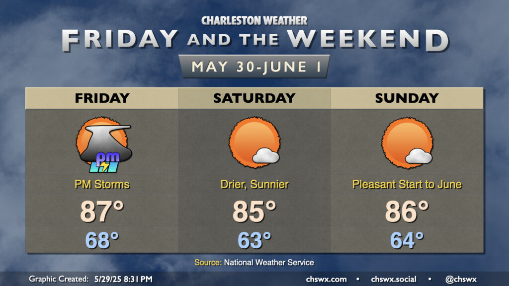
Friday & the weekend: Much better this weekend after a Friday front
A respite from the rain is coming just in time for the weekend (and it’ll be a beaut), but we’ve got one more day with storms — and the risk for a few severe storms, at that — coming up with a cold front on Friday.
Friday will be yet another warm and somewhat humid day, with lows in the upper 60s to near 70° warming to the upper 80s in the afternoon. Westerly winds will turn a bit breezy as we get into the heating of the day, and this trajectory will mix dewpoints down a little bit ahead of the line of storms, which may weaken it some as it approaches. We should get at least the first half of the day in rain-free, with ample sunshine as well. Clouds thicken as we head into the afternoon, though, and the line of storms (provided it holds together) looks to come into the area from the late afternoon through the evening hours.
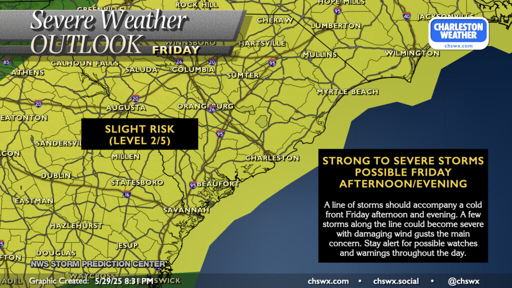
As mentioned earlier, it’s not out of the question that the line could be losing some steam as it approaches the coast. Model guidance has been trending a touch drier, but it still stands to reason that at least some of us will see storms. A few of those could still be on the strong to severe side, with damaging wind gusts the main concern. Be ready for possible watches and warnings as we get into Friday afternoon and evening.
The front sweeps through late Friday into early Saturday, and we’ll definitely notice by morning as lows fall to the low 60s across much of the metro. It’ll be a bright, sunny, and comfortably warm day as highs head to the mid-80s with dewpoints falling into the 50s. And if you like Saturday, we’ll do it again on Sunday as high pressure remains in control, with mid-80s highs once again — hard to ask for a better start to June and climatological summer!
Looking ahead: Quiet weather continues as temperatures head toward 90°
Heading into next week, expect quiet weather to generally continue across the area. Drier air will hang around Monday and Tuesday before dewpoints start to creep back into the mid-60s for the second half of the week. Rain isn’t in the forecast through at least Thursday, while temperatures will gradually warm back toward 90° by mid-week.
Follow my Charleston Weather updates on Mastodon, Bluesky, Instagram, Facebook, or directly in a feed reader. Do you like what you see here? Please consider supporting my independent, hype-averse weather journalism and become a supporter on Patreon for a broader look at all things #chswx!