The week ahead: Quiet start, but unsettled weather returns later in the week
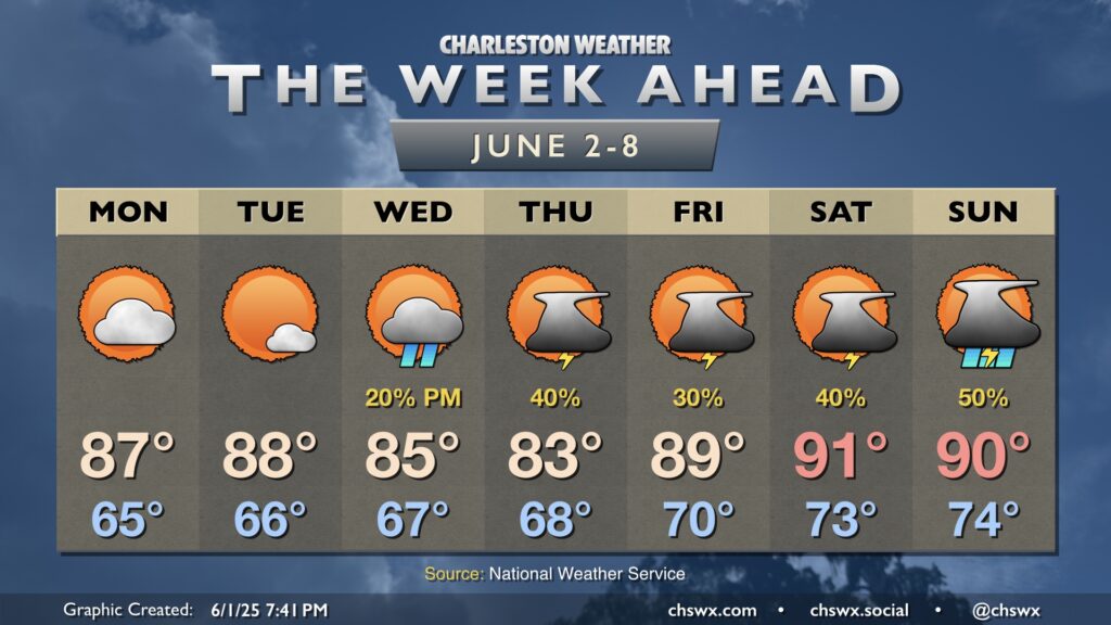
We will stay quiet heading into the first couple days of the work week, but low pressure moving into the area will help turn the weather more unsettled for the second half of the week and into the weekend.
Monday will be a bit on the smoky side as the upper-level trough that’s helping to direct lots of Saskatchewan-sourced wildfire smoke well into the eastern US. Temperatures will start in the mid-60s, warming to the mid-to-upper 80s with the smoke playing a small role in limiting the afternoon highs. Plenty of dry air will keep cloud coverage to scattered at most, and it should overall be another nice day.
We’ll turn a little warmer Tuesday as the trough shifts away and high pressure builds in aloft. This should also help to scour out some of the smoke. Temperatures respond well with lows in the mid-60s warming to the upper 80s to near 90° in the afternoon with just a few clouds dotting the sky.
From there, low pressure aloft will drift northward, and this combined with the heating of the day will keep shower and storm chances in play starting Wednesday afternoon and continuing basically each afternoon thereafter. Temperatures on Wednesday run on the cool side with some onshore flow, but temperatures rebound on Thursday with 90s expected by the weekend. Right now, the best chance for storms this weekend will be on Sunday as a front approaches, but as always, we’ll keep an eye on it.