The week ahead: Staying rather unsettled
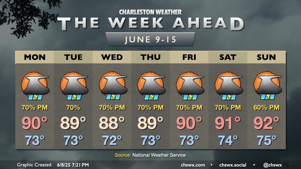
Warm, muggy, and unsettled weather will continue heading into this second week of June as a front stalls out nearby, which will help to instigate numerous showers and thunderstorms with the heating of the day each afternoon.
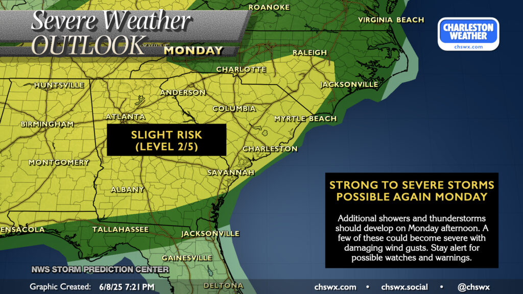
Another round of isolated to scattered severe thunderstorms will be possible Monday afternoon as one front stalls nearby, the seabreeze kicks in, and energy aloft moves by. Thunderstorms that can take advantage of the unstable environment will be capable of producing damaging wind gusts to 60 MPH, so stay weather-aware for possible watches and warnings as we head throughout the day Monday into Monday evening. Before storms get going, expect a muggy day with lows in the low-to-mid-70s warming to around 90° in the afternoon.
The trough aloft lifts away on Tuesday, but the seabreeze and stalled front remain players in the weather. Expect another busy afternoon of showers and thunderstorms, a few of which could still be severe, to fire on the seabreeze in the afternoon. Highs top out in the upper 80s to around 90° before storms fire.
All in all, expect scattered to numerous showers and thunderstorms each afternoon heading into the weekend as the pattern remains generally locked in with another stalling front and the seabreeze acting as triggers for convection. That being said, it won’t rain all the time either, especially in the mornings. Temperatures will continue to run generally in the upper 80s to low 90s each afternoon after muggy starts in the low-to-mid-70s.