Friday & the weekend: Stormy early-summer pattern continues
Active weather continues to be in the cards as we head into Friday and the weekend as we continue to sit on the western periphery of high pressure, allowing bits of energy aloft to ripple through at times to instigate more showers and thunderstorms. We’ll also have periods to dry out, too, with the sun getting through and helping temperatures build into the 90s by Sunday.
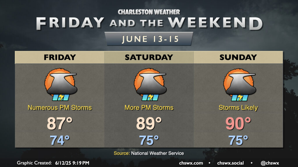
Friday starts in the mid-70s, warming into the mid-to-upper 80s in the afternoon. Showers and thunderstorms will ignite on the seabreeze and push inland, perhaps as early as mid-morning. Peeking at Thursday evening’s weather balloon data from NWS Charleston, the atmosphere largely recovered from earlier rains by evening with virtually no cap in place. Model guidance suggests that daytime heating will quickly erode whatever cap might form overnight, thus the potential for an earlier start to storms like we saw on Thursday in the US-17 corridor. They’ll become more numerous in the afternoon as daytime heating increases, the seabreeze pushes inland, and the initial round of collapsing storms emit outflow boundaries to help generate more storms. Heavy rain and lightning are the main concerns from any storms, though an isolated strong to severe storm can’t be ruled out where outflow boundaries collide. The early start to storms could yield another quiet evening, though, which wouldn’t be the worst thing on a Friday night.
We’ll keep the risk for periods of showers and thunderstorms in place as we head into the weekend. Ridging aloft will persist, allowing temperatures to gradually warm back to around 90° by Sunday, but we’ll also continue to have disturbances ripple across the area, which will continue to instigate showers and thunderstorms each afternoon. The risk for organized severe weather remains very low, though any boundary collisions could briefly produce storms capable of damaging wind gusts and hail. Remember, though, every thunderstorm is dangerous because of the lightning they produce, so when thunder roars, go indoors.
Follow my Charleston Weather updates on Mastodon, Bluesky, Instagram, Facebook, or directly in a feed reader. Do you like what you see here? Please consider supporting my independent, hype-averse weather journalism and become a supporter on Patreon for a broader look at all things #chswx!