Rest of the work week: One more very hot day, then returning to near-normal hot
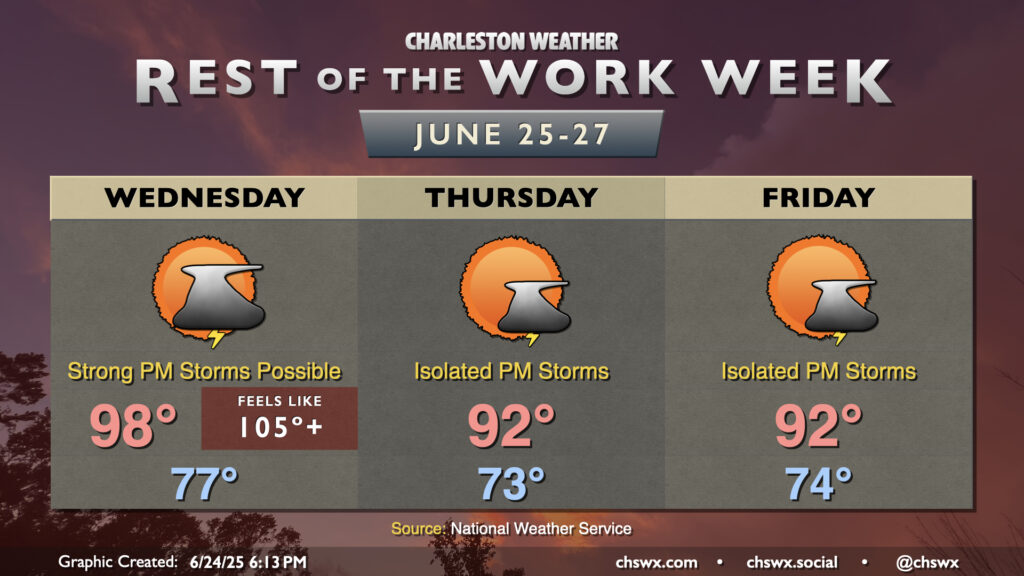
After reaching 98° today at the airport and 95° downtown, another very hot day awaits for Wednesday as air temperatures should once again make a run for the upper 90s in the afternoon, with heat indices once again peaking in the mid-to-upper 100s.
We will need to keep an eye on the skies on Wednesday afternoon and evening, though, as several of the high-resolution models suggest some sort of thunderstorm complex will develop in southern North Carolina and move southwest through the afternoon and evening hours. Plenty of instability will be available, and there will be a risk for these thunderstorms to produce strong, damaging winds. NWS’s current thinking on timing for any severe storms would be from 6PM-midnight, with the best risk for severe weather inland of Highway 17. We’ll keep an eye on this throughout tomorrow and will update as needed.
A more standard summertime pattern returns Thursday and Friday as high pressure aloft continues to weaken, allowing for the return of isolated to scattered showers and thunderstorms on the seabreeze each afternoon. The breakdown of the high also allows temperatures to return closer to, if not still slightly above, late June normals, with lows in the low-to-mid-70s and highs in the low 90s expected each afternoon. Dewpoints in the low 70s should generally keep heat indices topping out in the upper 90s to around 100°, especially in the immediate wake of the seabreeze. Of course, storms will impart some heat relief for a few of us, but don’t count on a storm to cool you off, either.
Follow my Charleston Weather updates on Mastodon, Bluesky, Instagram, Facebook, or directly in a feed reader. Do you like what you see here? Please consider supporting my independent, hype-averse weather journalism and become a supporter on Patreon for a broader look at all things #chswx!