Rest of the work week: Pretty standard July fare
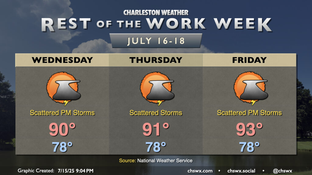
Warm and muggy conditions with a few afternoon storms continue across the Lowcountry for the rest of the work week, as we do in mid-July. Generally speaking, every day will feature very, very warm starts in the upper 70s to around 80° near the coast, with highs in the low 90s each afternoon. Highs warm as we get further along in the week with high pressure building back into the area, and we’ll turn even warmer as we head into the weekend.
Expect scattered showers and thunderstorms each afternoon along and ahead of the seabreeze. As usual this time of year, storms will be of the pulse variety (pop up, mature, collapse) and won’t produce any organized severe weather. However, where outflow boundaries from collapsing storms collide, storms could briefly turn strong to severe, with wet microbursts the most likely mode of severe weather. Regardless of severity, all thunderstorms are dangerous due to the lightning they produce. When thunder roars, go indoors!